Analytics
Deliver meaningful insights effortlessly, from simple point features to sophisticated, customized applications!
OneAtlas Analytics
Leverage Airbus premium satellite imagery, AI, and cloud computing to extract actionable insights fast, automatically, in a cost-effective way.
Starts from 1200€/year
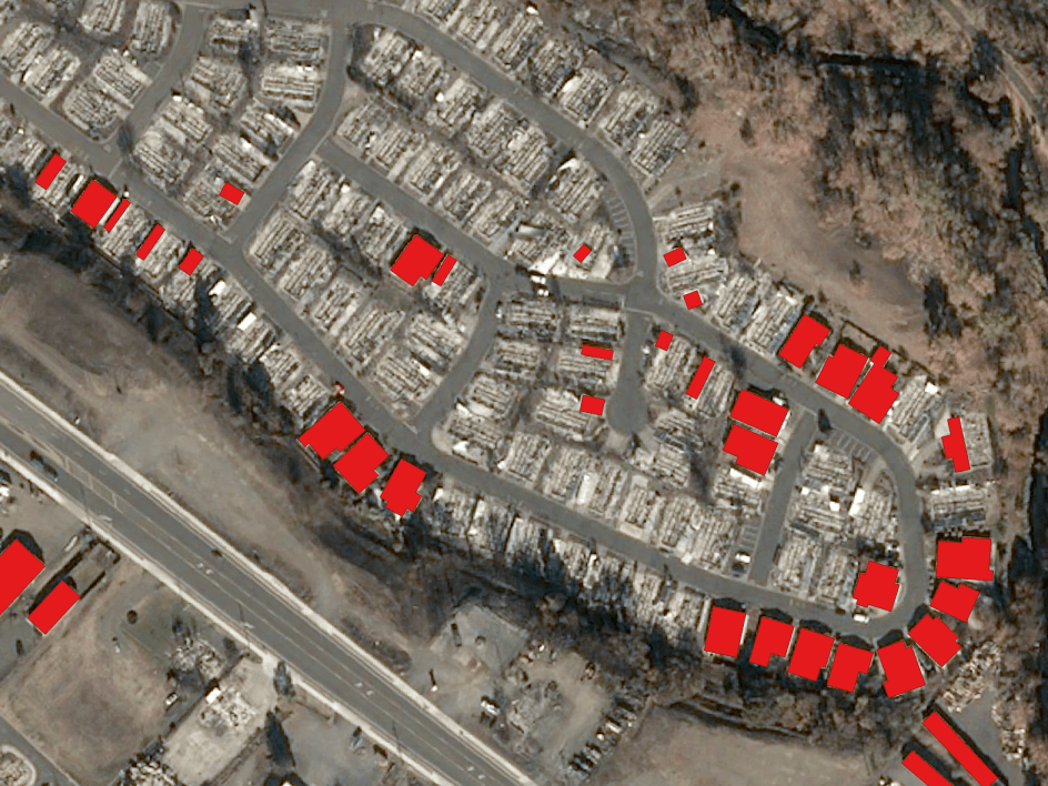
NEXTMap Link Planning
Quickly and efficiently identify obstructions penetrating the Fresnel zone or blocking the lines of sight between telecom towers.
Starts from 168.07€/month
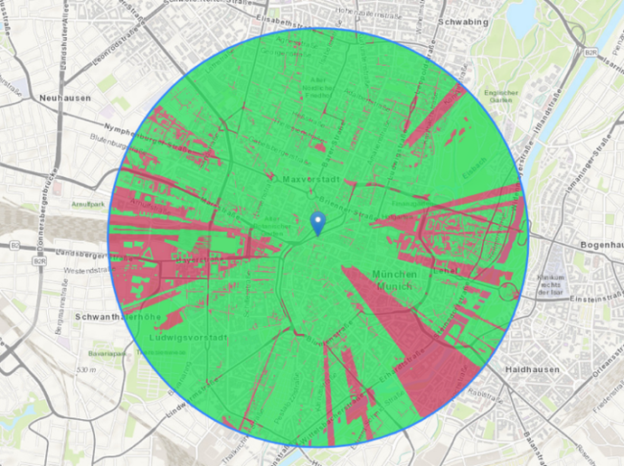
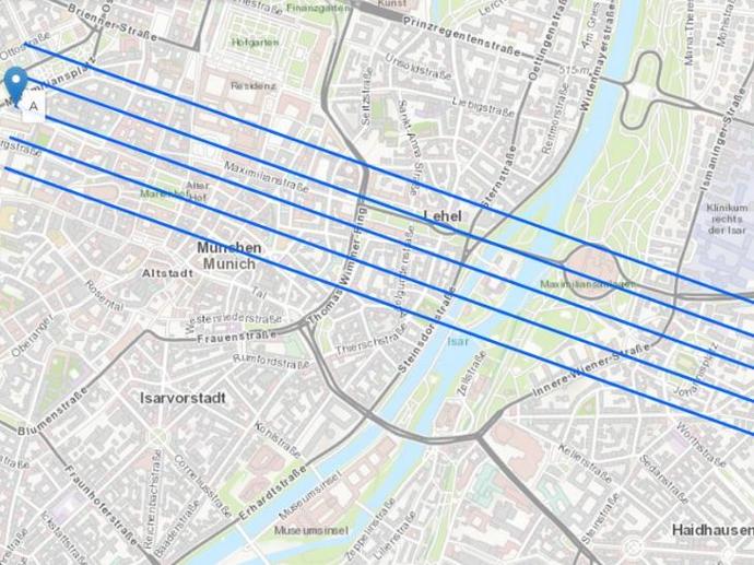
NEXTMap Viewshed
Generate instantly 360° communications coverage maps, visibility, and obstruction analysis around any point on the globe based on Intermap’s NEXTMap elevation data.
Starts from 148.72€/month
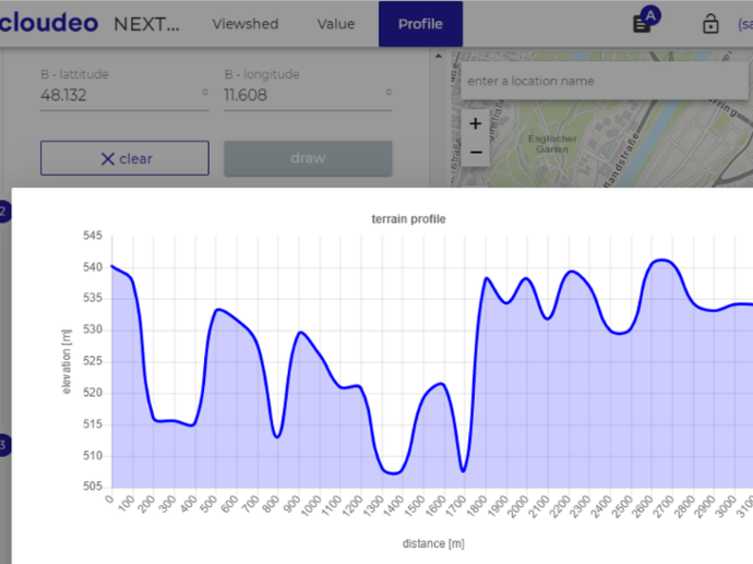
NEXTMap Profile
Retrieve detailed terrain information anywhere in the world, with unlimited profiling distance.
Starts from 185.58€/month
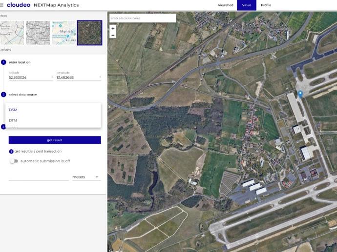
NEXTMap Value
Get instantly precise elevation information at any point in the world, based on the highly accurate NEXTMap data sets from Intermap.
Starts from 146.25€/month
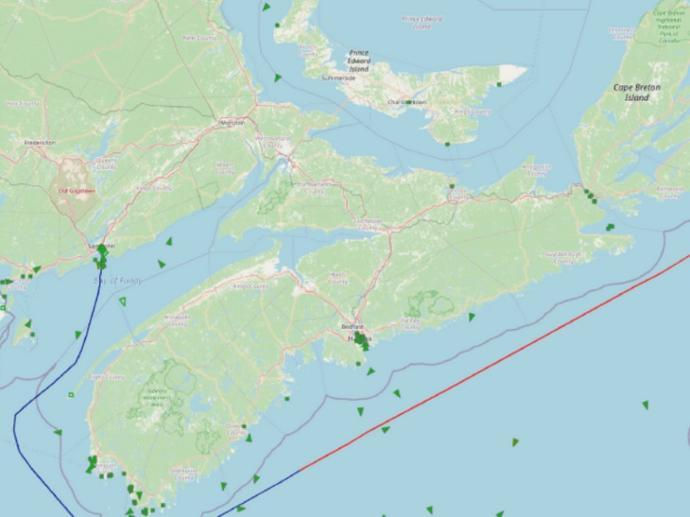
TimeCaster™
Get near real-time vessel positions and predictions of up to 72 hours, ten times more accurate than other datasets!
Starts from 3000€
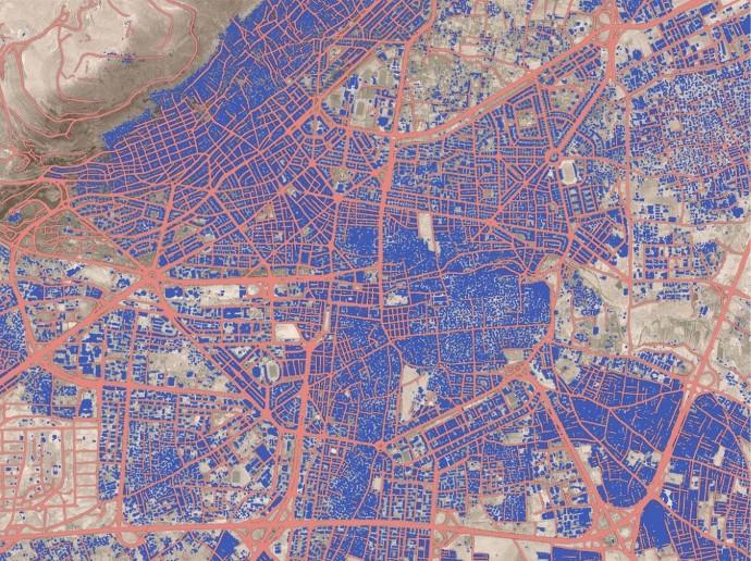
Planet Basemap Analytic Feeds
Start leveraging deep learning to identify roads, buildings, silo bags and well pads from Planet imagery on a global scale!
Starts from 500€
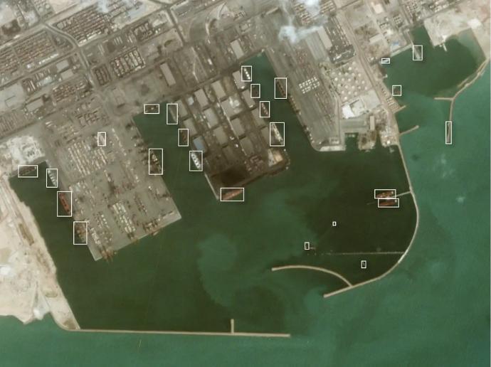
Planet Monitoring Analytic Feeds
Take advantage of the automated, cloud-based, and global-scale Planet Analytic Feeds for vessel and aircraft detection over your area of interest.
Starts from 900€
Software as a Service
Access geospatial software as a Service, fully deployed and ready to use in the cloud - no local installation is required!
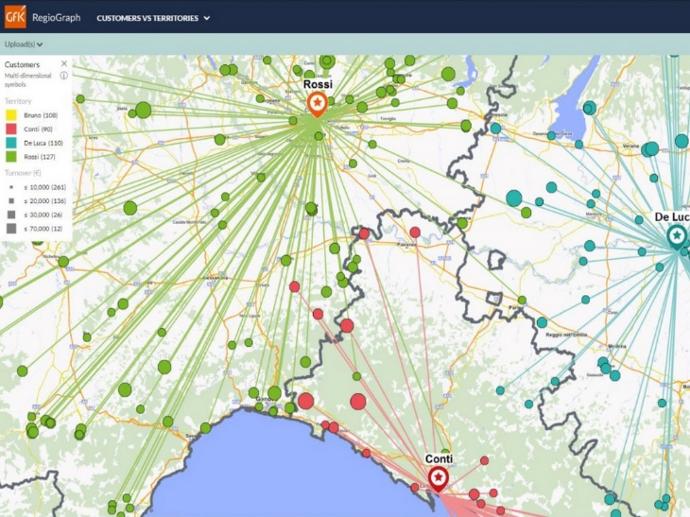
RegioGraph TeamConnect
The best team communication tool to start planning and optimizing your sales territories at street level based on competitor influences - no need for installation, all on the cloud.
Starts from 5746€
Platform as a Service
Access geospatial platforms as a Service, ready to use online - all the set-up is performed by us.
Geo Insurance
Access localized and agriculture adapted climatic variables and natural disasters risks anywhere on the planet from 1980.
Starts from 2500€
Sentinel Hub
A powerful cloud-based data API that removes the complexity of processing large volumes of satellite data.
Starts from 30€ / month