Intermap Technologies
Headquartered in Denver, Colorado, Intermap Technologies® is an industry leader serving a diverse geospatial marketplace. Intermap is always building new solutions and its growing geospatial library powers AI-driven algorithms, making each new solution faster, more affordable, and richer in information. Intermap distributes products and solutions globally, with simple and lightweight architecture, through the cloud, or behind a firewall.
Whether the requirements are for better terrain awareness, change detection, feature extraction, foundation mapping, or predictive analytics, customers on every continent can leverage Intermap's architecture to maximize their geospatial investment. Intermap’s vertically integrated products, solutions, and software simplify many large-scale terrain data challenges and make the solutions accessible to non-expert users.
Products:
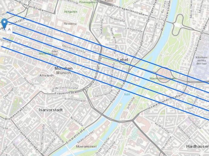
NEXTMap Link Planning
Starts from 168.07€/ month
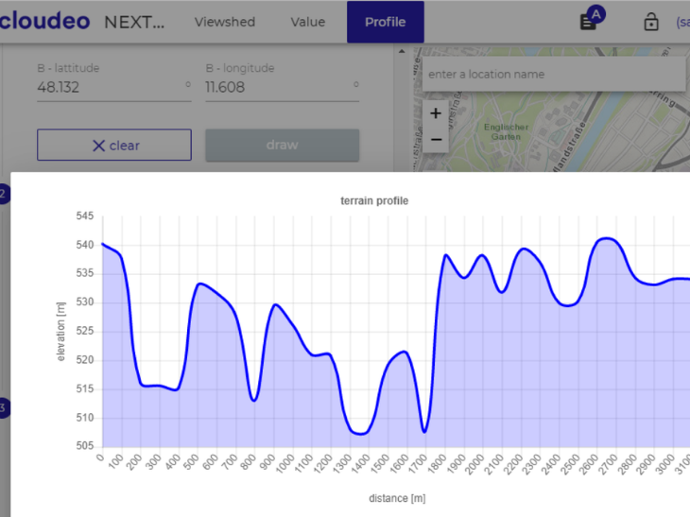
NEXTMap Profile
Starts from 185.58€/ month
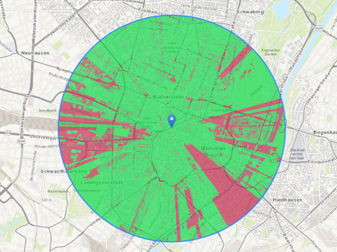
NEXTMap Viewshed
Starts from 148.72€/ month
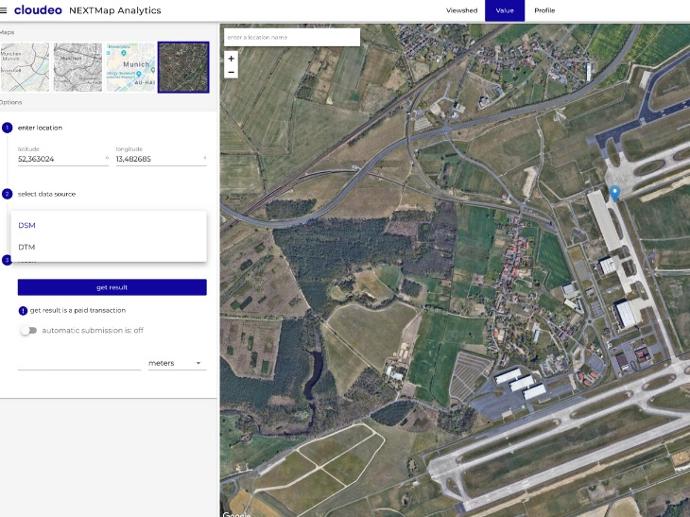
NEXTMap Value
Starts from 146.25€/ month
NEXTMAP One™
Starts from 500€
NEXTMap World 10
Starts from 2150€
Lido Surface Data NEXTView
Starts from 1000€