Hexagon Streaming Service
The HxGN Content Program is a high-quality ortho imagery streaming service for professionals in the United States and parts of Europe. Stream aerial image base maps into your geospatial and enterprise applications.
All imagery is orthorectified with 30 cm resolution coverage of the United States and parts of Europe and 15 cm resolution in metro areas (cities larger than 50,000 population) of the United States. The service provides current and accurate orthorectified imagery that meets international industry standards, is refreshed on a pre-planned schedule and available by streaming through OGC WMS/WMTS protocols.
Stream imagery using protocols such as ArcGIS, OGC WMS and WMTS directly into your GIS or enterprise application of choice, including Esri, MapInfo, and Global Mapper. Subscription fees include unlimited viewing and plotting.
Please specify in the remarks field which County, Metro area, or State in the USA, or Country in Western Europe you would like to stream.
Spatial Resolution | 15cm | 30cm |
Accuracy | RMSEx/y = 0.50 m RMSEr = 0.71 m | RMSEx/y = 1.2 m RMSEr = 1.7 m |
Delivery Method | Web Streaming |
Data layers | - RGB imagery (15 cm and 30 cm) - Color-Infrared imagery (15 cm and 30 cm) -RGB or CIR aerial imagery for an entire year (15 cm or 30 cm) |
Delivery Protocols | OGC WMS / WMTS ArcGIS REST/SOAP |
Format | JPG, PNG, GIF |
| Delivery Time Frame | Immediate |
Key features
Online library of 30 cm and 15 cm (urban areas)
Available across the United States and some parts of Europe
Optimized with the newest imagery available
Orthorectified aerial imagery
Web Map Service (WMS) and Web Map Tile Service (WMTS) based on OGC specifications
True Color (RGB) and False Color (CIR) imagery available
Key applications

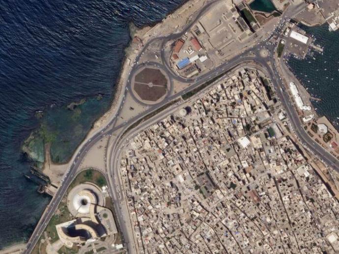
Infrastructure
Monitoring construction sites
Analyzing roads' condition
Creating a base map for visual reference
Monitoring construction sites
Analyzing roads' condition
Creating a base map for visual reference

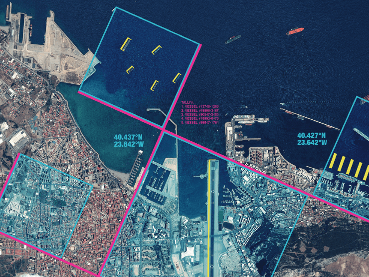
Maritime
Detecting ships and vessels
Mapping oil spills
Mapping of fishing zones
Detecting ships and vessels
Mapping oil spills
Mapping of fishing zones

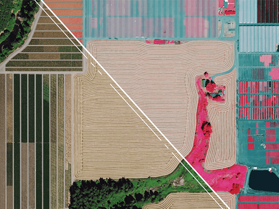
Forestry
Mapping trees spatial distribution
Tree health assessment
Estimating tree annual growth
Mapping trees spatial distribution
Tree health assessment
Estimating tree annual growth
FAQs
Sure. You can add Hexagon aerial imagery as WMS/WMTS/SOAP to the following software:
ESRI ArcMap
ESRI ArcGIS Pro
QGIS
Global Mapper
The pricing of Hexagon Streaming Service is subscription-based, which incudes unlimited viewing and plotting of the Hexagon imagery.
Each subscription is tailored to your desired area of interest. You can subscribe to a county, a metro, an entire state or the whole of the United States, depending on your needs. The subscription by zone enables complete cost transparency.
The EULA of Hexagon products can be found here.