OneAtlas Living Library
OneAtlas is a unique collaborative environment to easily access premium imagery, perform large-scale image processing, extract industry-specific insights, and benefit from Airbus assets to develop your solutions. OneAtlas Living Library, part of the OneAtlas platform, is the quick and easy access mode to premium Airbus high resolution satellite imagery, in multiple streaming and download formats.
Living Library is available through OneAtlas web user interface or directly through APIs to synchronize it with your favorite GIS solution.
Airbus' multi-resolution optical archive, updated daily, currently hosts more than three years of 0.5m and 1.5m imagery globally and more than five years over 3,000 metropolitan areas in the world. Available formats are WMTS and WMS. Catalogue Search, View through Streaming and Download capabilities are provided. The access to the OneAtlas Living Library data is available through a usage-based yearly subscription model.
Custom packages are also available, please contact us.
Key features
Quick access to SPOT 6/7 and Pléiades imagery.
API to synchronize with any GIS platform.
Usage-based yearly subscription models.
Multi-resolution optical archive.
Daily basis update.
OGC compliancy.
Key applications

Forestry
Forest tree health monitoring
Burnt forest mapping
Number of trees per unit area (density)
Forest tree health monitoring
Burnt forest mapping
Number of trees per unit area (density)

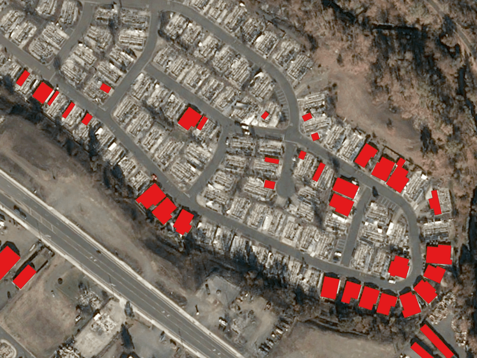
Infrastructure
Monitor construction sites
Creating a base map for visual reference
Site selection process
Creating a base map for visual reference
Site selection process

Agriculture
Determine crop damage and crop progress
Drought Monitoring
Crop health analysis
Determine crop damage and crop progress
Drought Monitoring
FAQs
SPOT 6/7 offer high resolution imagery over broad areas in a single pass at resolutions up to 1.5m. Such precise coverage is ideal for applications at national and regional scales from 1:250,000 to 1:15,000. SPOT 6 and SPOT 7 operate in an 180-degree phased orbit, allowing for daily revisit anywhere on Earth.
The Pléiades 1A and Pléiades 1B satellites deliver 50cm imagery products with a 20km swath, offering daily revisit capacity anywhere on the globe.
Airbus offers a pretty cool tool to answer this question! Visit it here.
Airbus Defence & Space Terms & Conditions apply.