SPOT 6/7

https://www.cloudeo.group/web/image/product.template/92/image_1920?unique=3a8acac
  • Service Provider​
  • Thematic Information
  • Service Option​s
  • Features​ Provided
  • Access Mode​
  • Pricing Options
  • Pricing​
  • Free Trial
  • Delivery Time​
  • Compatible products
  • Mission
  • Sensor & Data Products
  • Data Processing Level
  • Data Format​
  • Spectral Bands
  • Spatial Resolution​
  • Spatial Coverage
  • Temporal Coverage
  • Temporal Resolution
  • Accuracy

From 90€

From 90€

This combination does not exist.


Provided by Airbus Defence & Space


cloudeo Terms and Conditions

The ideal solution for country-wide, demanding applications, covering large areas in a single pass at resolutions up to 1.5m.

Interested in SPOT 6/7 imagery and products?

Fill out a form with all your requirements and we will contact you as soon as possible with a quote!

SPOT 6/7

The SPOT imagery products offer high resolution over broad areas using the SPOT satellites.

An acquisition covers large areas in a single pass at resolutions up to 1.5m, and with a location accuracy up to 10m. Such precise coverage is ideal for applications at regional and local scales from 1:250,000 to 1:15,000.

The archive contains imagery acquired since 2012, ideal for temporal evolution monitoring.


SPOT 6/7 benefit from a large swath, enabling a daily acquisition capacity of 6 million km². The satellites are specifically designed to efficiently provide large-area coverages, making them particularly suitable to serve cartographic and monitoring applications ideally for 1:15,000 topographic mapping. They also have stereo and tristereo capacity, with a daily revisit anywhere.

Some of the SPOT6/7 benefits include feature extraction, 2D & 3D stereo plotting, geometric accuracy down to 1.2m CE90, elevation and contour lines, huge coverage capacity strengthened by efficient management of weather forecasts, ultimate reactivity from new acquisition ordering to product delivery, and highly accurate, orthorectified imagery as a standard.

Launch
SPOT 6: September 9, 2012
SPOT 7: June 30, 2014

Orbit

Sun-synchronous
10:00 AM descending node
26-day cycle
694-km altitude

Spectral bands

Pan: 0.455-0.744 mm
Blue: 0.454-0.519 mm
Green: 0.527-0.587 mm
Red: 0.624-0.694 mm
Near-IR: 0.756-0.880 mm
Spatial resolution
Panchromatic @ 1.5 m;
Multispectral @ 6.0 m
Radiometric resolution
12 bits per pixel
Geometric precision< 10 m CE90
Revisit timeDaily


And some technical specifications related to the ordering process:

Imagery type
SoloA single image is delivered over your AOI
Stereo
Two images over the area of interest within the same orbital pass. Each of the two images are shot with a different viewing angle within the same orbit,
enabling the creation of 3D models over the area of
interest. Subject to feasibility study
Tristereo
Three images over the area of interest within the same orbital pass. Each of the three images are shot with a different viewing angle within the same orbit, enabling the creation of 3D models over the area of interest. The second image is acquired nearly vertically. The near-nadir acquisition minimises the risk of missing hidden items, which makes it ideal for dense urban and mountainous areas. Subject to feasibility study
Processing level
PrimaryProcessing level closest to the natural image acquired by the sensor. Optimal for clients familiar
with satellite imagery processing techniques wishing to apply their own production methods (e.g. orthorectification or 3D modeling). RPCs and the sensor model are also provided.
Ortho
 A georeferenced image in Earth geometry,
corrected from acquisition and terrain off nadir effects. Optimal for simple and direct use of the image.
Band selection
 
PanchromaticBlack and white (1.5 m)
Pansharpened 3-band natural color
Panchromatic merged with the Blue, Green and Red bands (1.5 m)
Pansharpened 3-band false color
Panchromatic merged with the Green, Red and Near Infrared bands (1.5 m)
Pansharpened 4-band
Panchromatic merged with the full set of colour Blue, Green, Red and Near Infrared bands (1.5 m)
Bundle (PAN + 4MS)
One Panchromatic image (1.5 m) + the
Multispectral (6 m - Blue, Green, Red and Near Infrared) bands delivered separately (not merged)
Multispectral 4-band
Full set of colours Blue, Green, Red and Near Infrared bands (6 m)


Need a sample to test the product before ordering?
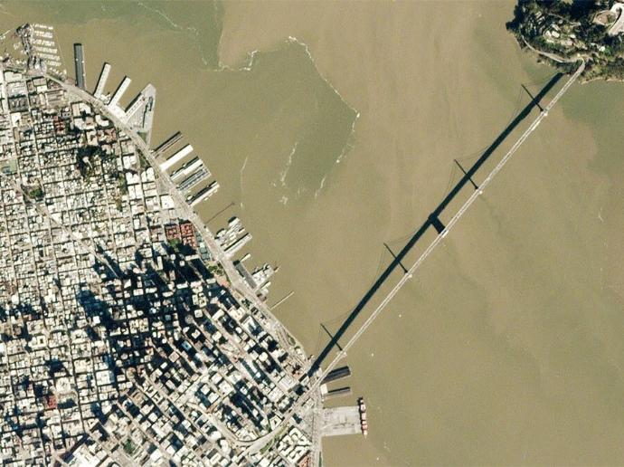
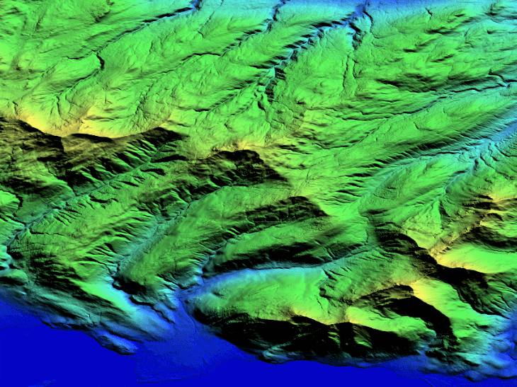
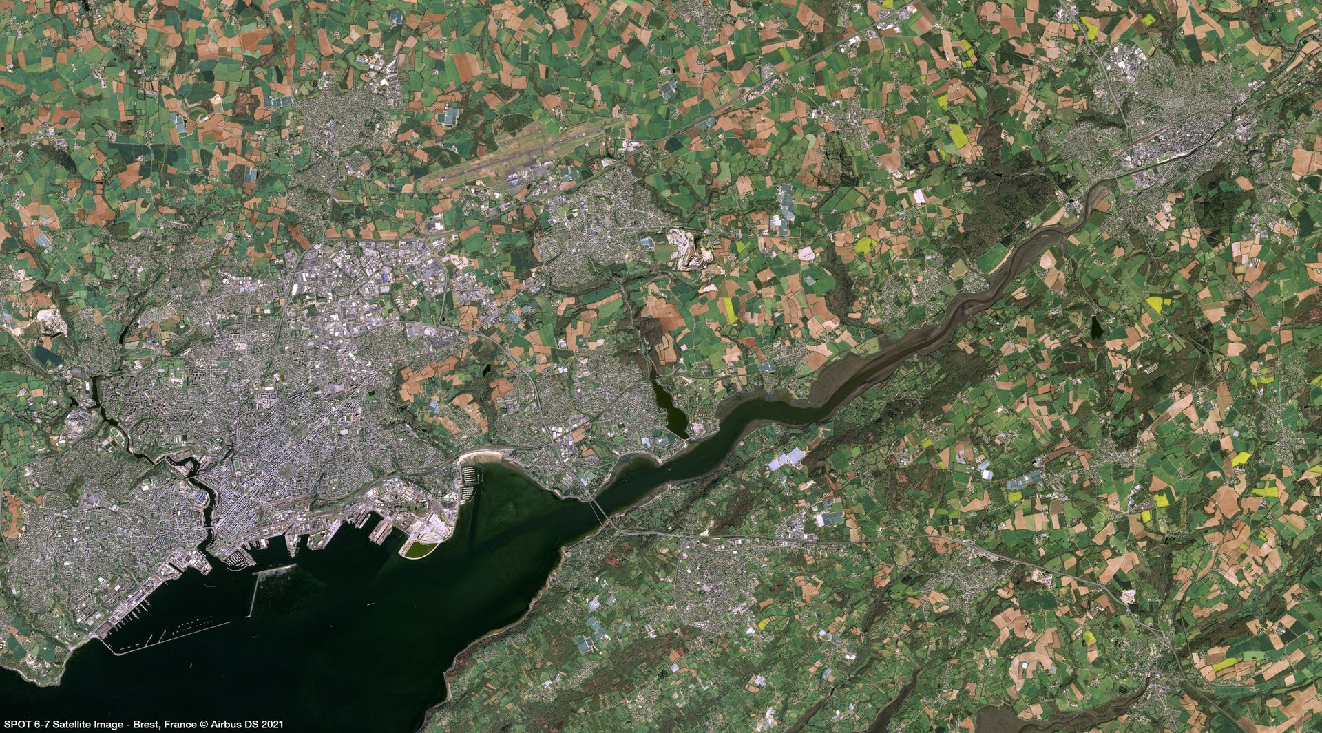
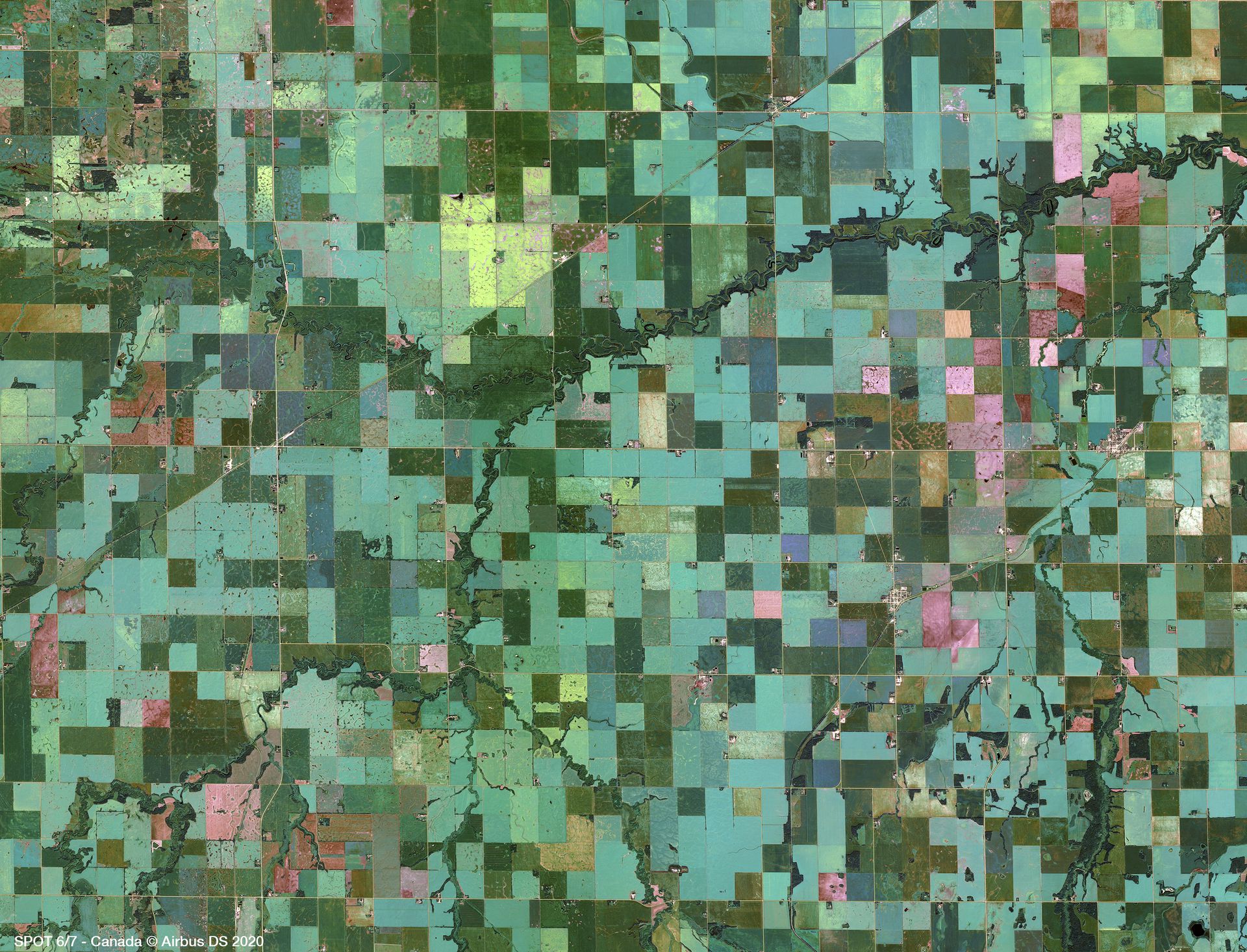
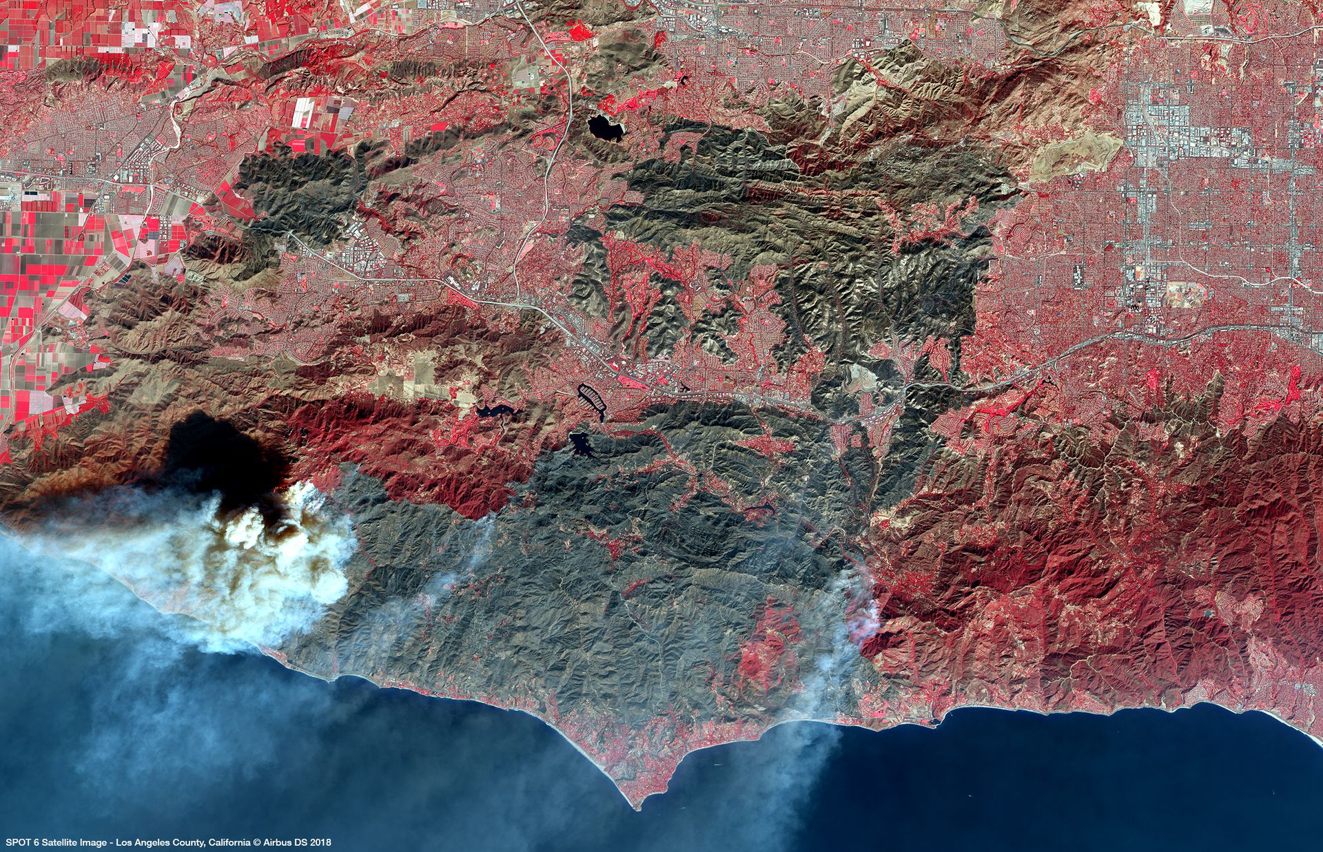
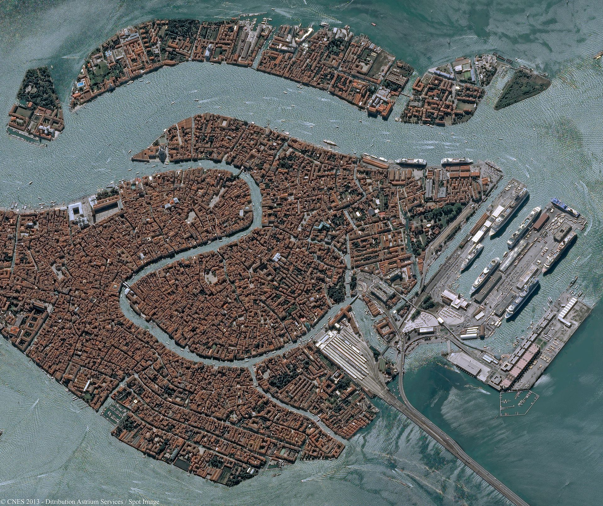
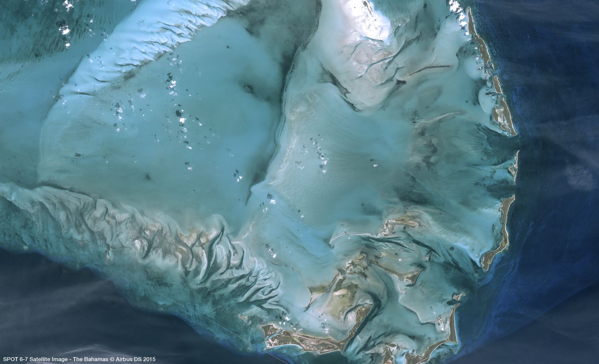
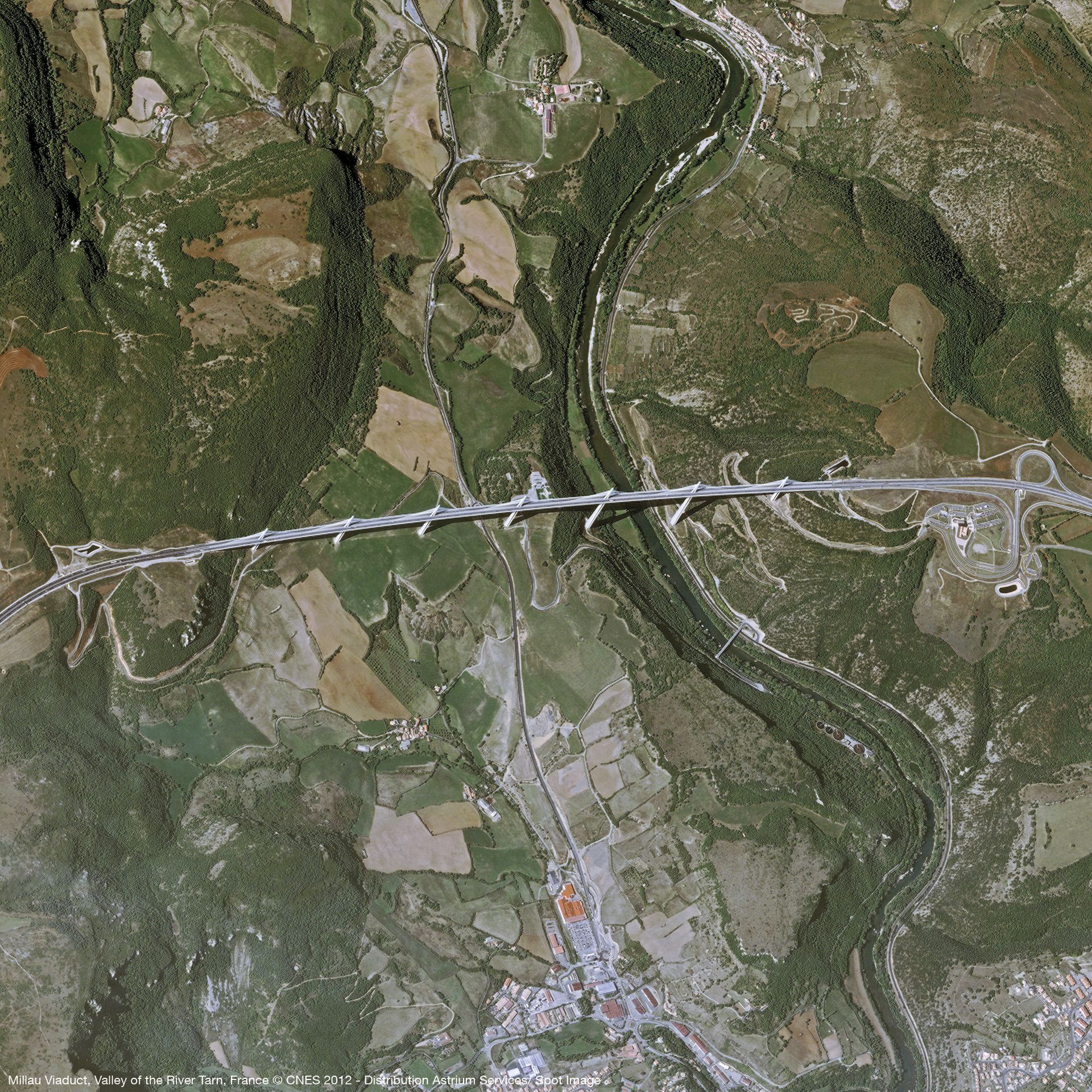
Protected by reCAPTCHA, opting in Newsletter, Privacy Policy applied. 

Your sample request has been sent

Our team will message you back as soon as possible in the provided email.

Gallery

Key features

Quick access to very high resolution imagery up to 1.5m

Geometric accuracy down to 1.2m

Regional or National coverage in record time

Optimal combination of resolution, coverage and accuracy

Image availability secured until 2024

Accurate orthoimagery guaranteed by Reference 3D database

Key applications

Agriculture

Optimize the number of plants per unit of area

Crop condition analysis and stress detection

Crop type classification and mapping

Forestry

Detecting deforestation and forest degradation

Burned and flooded forest mapping/monitoring

Assessing slope failure and soil erosion

Maritime

Mapping of fishing zones

Forecasting algal blooms

Supporting environmental regulations and Marine Protected Areas (MPAs)

FAQs

Yes, the minimum required area of interest is 100km², with at least 5km in one direction.

In case more than one AOI is required, please contact us for a custom order tailored to your needs.

The EULA of SPOT 6/7 is under the authority of Airbus Space & Defence and can be found here.

Request quote

Protected by reCAPTCHA,  I have read and accept the Privacy Policy

People also viewed

Do you have more questions about the product?

We are here for you! Please contact us and we will come back to you shortly!

Specifications for SPOT 6/7

General Info
Service Provider​ Airbus Defence and Space
Thematic Information Multispectral Satellite Imagery
Service Option​s 1.5m Panchromatic; 1.5m Pansharpened 3-band natural color; 1.5m Pansharpened 3-band false color; 1.5m Pansharpened 4-band; 1.5m Bundle (PAN + 4MS); 6m Multispectral 4-band; Solo; Stereo; Premium Ortho; Tristereo; Basic; Reflectance; Display
Features​ Provided Archive; Tasking
Access Mode​ File transfer
Pricing Options Pre-paid
Pricing​ Per km²; min. order 100 km²/AOI
Free Trial On demand
Delivery Time​ Up to 5 business days
Compatible products Standalone; SaaS
Geodata Specs
Mission SPOT 6/7
Sensor & Data Products MSI
Data Processing Level Primary(L1);Ortho(L3)
Data Format​ GeoTIFF; JPEG2000
Spectral Bands PAN; RGB; NIR
Spatial Resolution​ 1.5m; 6m
Spatial Coverage Global
Temporal Coverage Since 2012
Temporal Resolution Daily
Accuracy 1-3m