FOSS4g Stack: Internet Mapping with Geoserver
If so, this course is for you and your team.
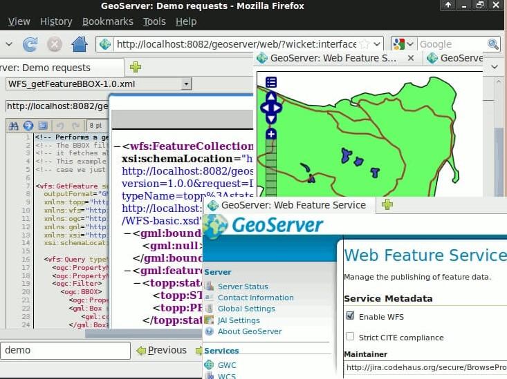
You will be walked step-by-step through the process of installing Geoserver, loading data, creating server-side analytical processes, and finally, see how to render the data on the client-side using Openlayers 3.0. When you finish this course, you'll be acquainted with all the basics and you will be ready to start using this knowledge on your own web application.
Instructor: Dr. Arthur Lembo, Professor in the Department of Geography and Geosciences at Salisbury University, Maryland.
What you'll learn
How to install and operate Geoserver.
Serve vector, raster, and attribute data on the Internet with Geoserver.
Set up Geoserver so that it operates like a cloud-based spatial data server.
Create an application that allows clients and a server to interact with data and users over the internet.
How to serve up data from multiple sources like Postgres, Geopackage, SQLite, and shapefiles.
How to develop back-end server processing to deliver the results of spatial operations. You'll do this with both SQL and CQL.
Create a frontend web mapping browser, using OpenLayers.
Key features
Learn how to create within your company impressive and functional Internet mapping websites.
Claim your Certificate of Completion with no extra cost.
Study at your best time - online and always accessible.
Even when you finish the course and you get your certificate, you will still have access to course contents.
Key applications

Train your company
Train newest members
Stay updated on GIS applications, Remote Sensing techniques and Space technologies

Research & Academia
Fill in knowledge gaps
Continuing education on GIS applications, Remote Sensing algorithms and techniques and Space technologies
Fill in knowledge gaps
Continuing education on GIS applications, Remote Sensing algorithms and techniques and Space technologies
FAQs
The online course is hosted in the platform of GEO University. After the purchase, you will be sent further information on how to access the course from the GEO University platform.
You get access to the course for ever! You pay once and you get access to the entire course content and their updates for ever.
No. Your certificates of completion remain active for ever.
You can share it in your social media accounts and you can add it to your CV, LinkedIn profile etc as proof of knowledge.
In case you want multiple people to access the course, please fill out the Quotation Form below and add your exact needs in the 'Your Question' field. We will contact you as soon as possible!
Terms & Conditions and Privacy Policy of GEO University apply.