We are so excited to announce our new partnership with ConstellR, a space data and services company leading the way in delivering daily, global land surface temperature maps! ConstellR's high-resolution and high accuracy thermal infrared data is perfect for applications in the agriculture, oil & gas and maritime markets, and will be soon available in our marketplace.
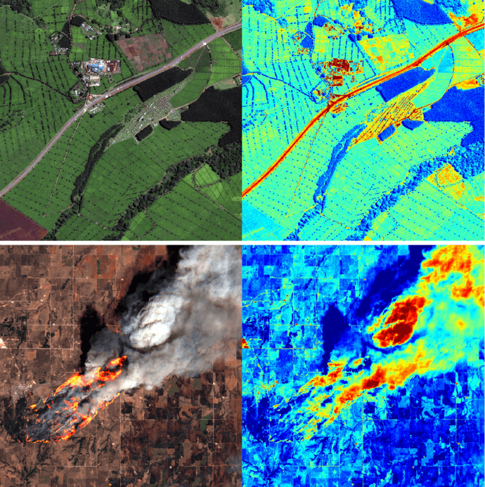
The partnership also allows cloudeo to enhance its Geo-Insurance product, an automated service delivering insights on crop health to insurance companies. ConstellR’s global temperature monitoring products and strong data science capabilities will help enhance the quality and accuracy of cloudeo’s crop damage monitoring and day-to-day farm management services, covering drought monitoring, heatwave- or frost-damage identification and cost-effective irrigation insights. The performance of cloudeo’s crop type classification deep learning pipeline is also expected to be enhanced.
Based in Germany, ConstellR is pioneering the use of space-based thermal infrared imagery for high-precision agriculture, crop health monitoring and sustainable resource management. With surface temperature as the key indicator, the company uses evapotranspiration as a fundamental measure of crop water need; critical for irrigation, yield monitoring and enhancement. Unlike all other satellite-based approaches to crop monitoring, ConstellR’s data allows farmers to mitigate potential crop losses long before irreversible damage occurs. Their first system will launch into orbit in February 2022.
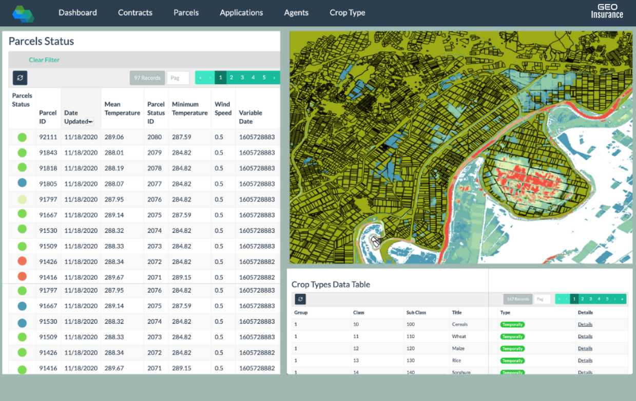
cloudeo is the world’s leading geospatial market platform offering easy access to high-quality, ready-to-use data from industry leaders worldwide as well as software application services and consulting. cloudeo has also developed Geo-Insurance, an online, fully automated platform focused on delivering insights to insurance companies and farmers for crops. Geo-Insurance helps estimate risk, portfolio exposure, fraud detection, and claim inspection prioritization, all tailored to the client's needs. cloudeo has headquarters in Munich, Germany. cloudeo recently expanded its presence with a new subsidiary (cloudeo Hellas) in Athens, Greece.
cloudeo will leverage its deep experience and heritage in the Earth Observation market to provide easy access to - and publicity for - ConstellR’s data in the geospatial community, enriching its partner product portfolio with unique high resolution and temperature accuracy data layers. Geoanalytics companies across agriculture, public (governmental), as well as oil & gas and maritime markets are the main targeted customer groups based on their interest in thermal data. Furthermore, cloudeo will utilize its geospatial partner network to widely promote ConstellR’s data for integration into new and existing geospatial applications.
The two geospatial companies are not only joining forces to help find novel ways to distribute Earth Observation data and upgrade cloudeo’s damage assessment capabilities; their longer term plan is also to explore the potential for joint product development, with a roadmap of activities already in planning.
About ConstellR
ConstellR is a space data and services company leading the way in delivering daily, global land surface temperature data for the agri-tech industry. ConstellR provides the fundamental global data for smart crop monitoring, identifying changes in crop health days to weeks before they become visible and enabling farmers to react early to and mitigate for potential crop risks and losses. This advanced warning means the risk of crop failure or damage is significantly reduced, allowing more accurate crop yield forecasting and thus better stability and management across supply chains.