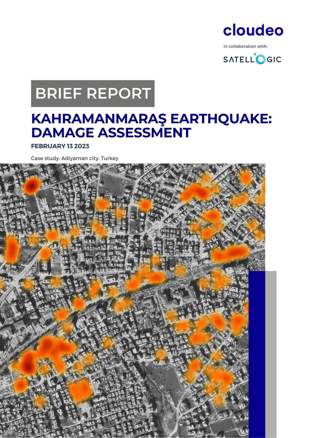
On the 6th of February 2023, a seismic event of magnitude 7.8 occurred in southern-central Turkey, as well as in northern-western Syria. Nine hours later, another earthquake of magnitude 7.7 transpired, with the epicenter located 95 kilometers to the north-northeast of the former, in the province of Kahramanmaraş. The natural disaster caused widespread devastation and resulted in a staggering number of fatalities, amounting to tens of thousands.
In response to this catastrophic occurrence, Cloudeo and Satellogic jointly collaborated. On February 13, Satellogic acquired an image that depicts the condition of Adiyaman precisely one week after the severe earthquake. The high-resolution Satellogic - Multispectral imagery with a pixel size of 70cm, was analyzed and processed by Cloudeo to identify the affected buildings that suffered partial or complete damage.
Interested in Satellogic - Multispectral?
Get sub-meter resolutions, perfect for high-frequency changes monitoring of infrastructure and natural environment!
Damage assessment
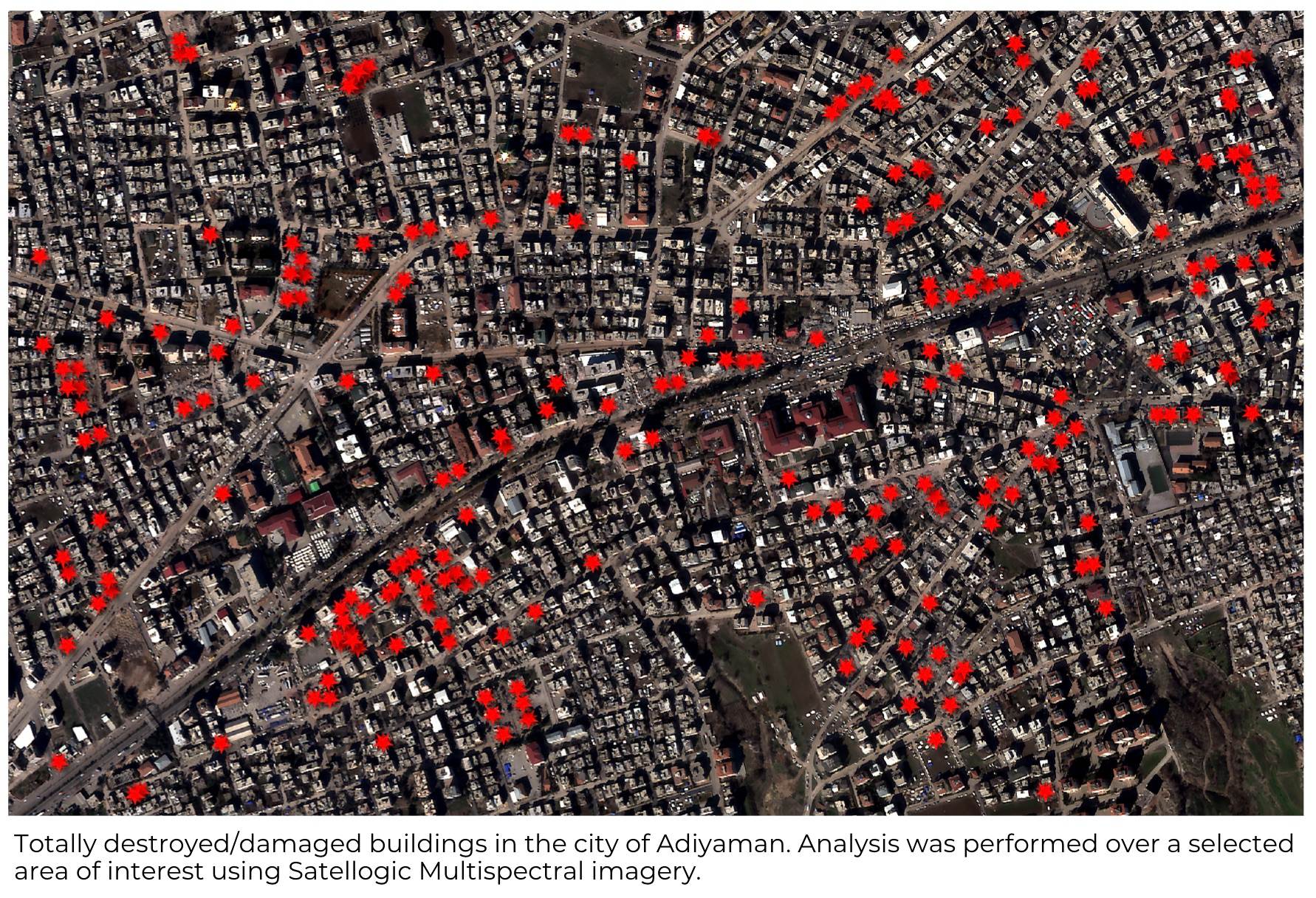
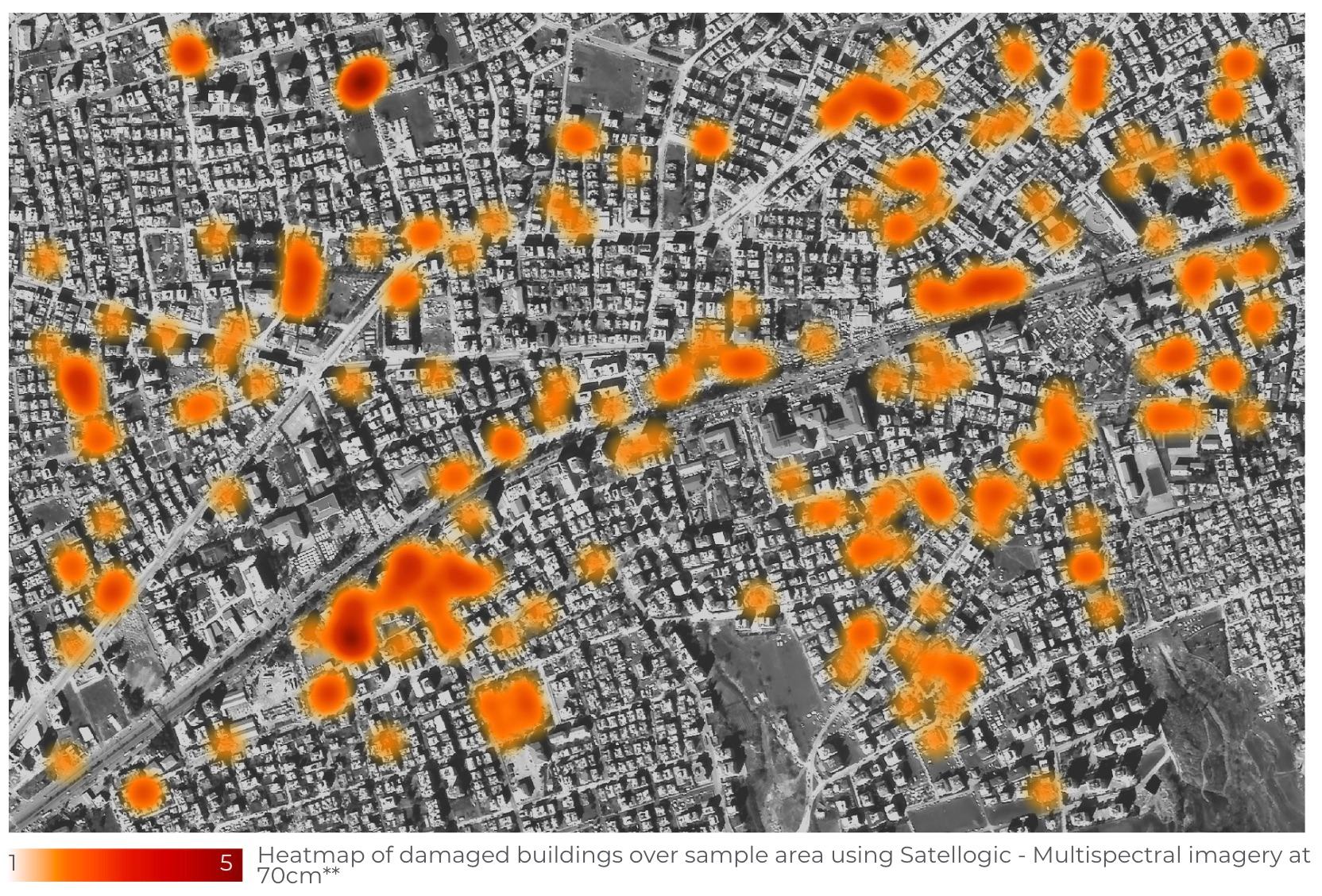
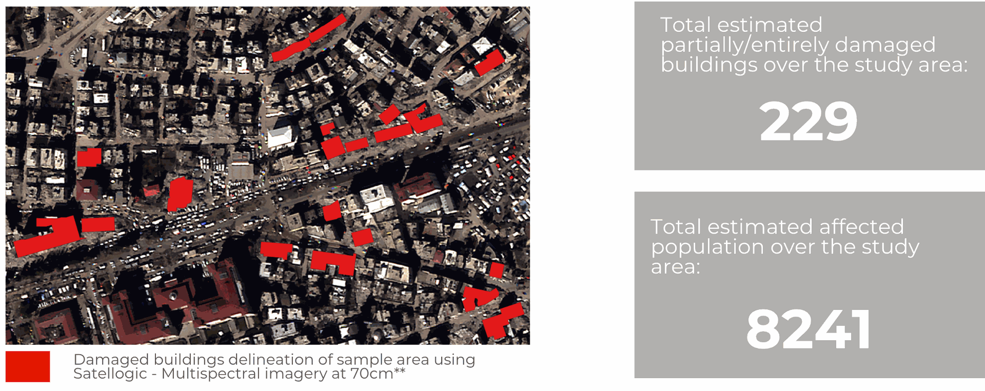
The analysis was conducted over a specific area within Adiyaman where significant damage was observed (figure below). Based on our assessment, a total of 229 structures, including buildings and other constructions, were found to have incurred partial damage or complete destruction as a result of the earthquake. Furthermore, it is estimated that over 8,000 people have been affected by the disaster, only in these locations *.
Before & after visualization
Visual photointerpretation of building damage assessment in various locations within the study area using Satellogic's multispectral imagery captured on February 13 and comparing it to Bing Maps (scale: 1:1,500):

Download the Brief Report of the Kahramanmaraş Earthquake over a selected region of Adiyaman city, Turkey, and discover how you can take advantage of very high-resolution satellite imagery, like Satellogic Multispectral, to gain valuable insights to support rescue and recovery efforts during an extreme human crisis event: