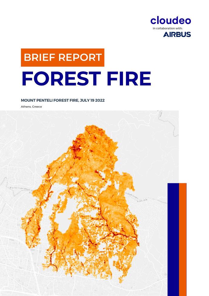
On July 19, 2022, a forest fire broke out on Penteli mountain, located on the outskirts of Athens, the capital of Greece. Due to extreme weather conditions - continuous high temperatures and strong winds over the area, the fire expanded up to inhabited areas of the urban fabric, causing the evacuation of hundreds of people from their homes.
Three municipalities in North Athens were seriously affected: Penteli, Rafina-Pikermi, and Pallini.
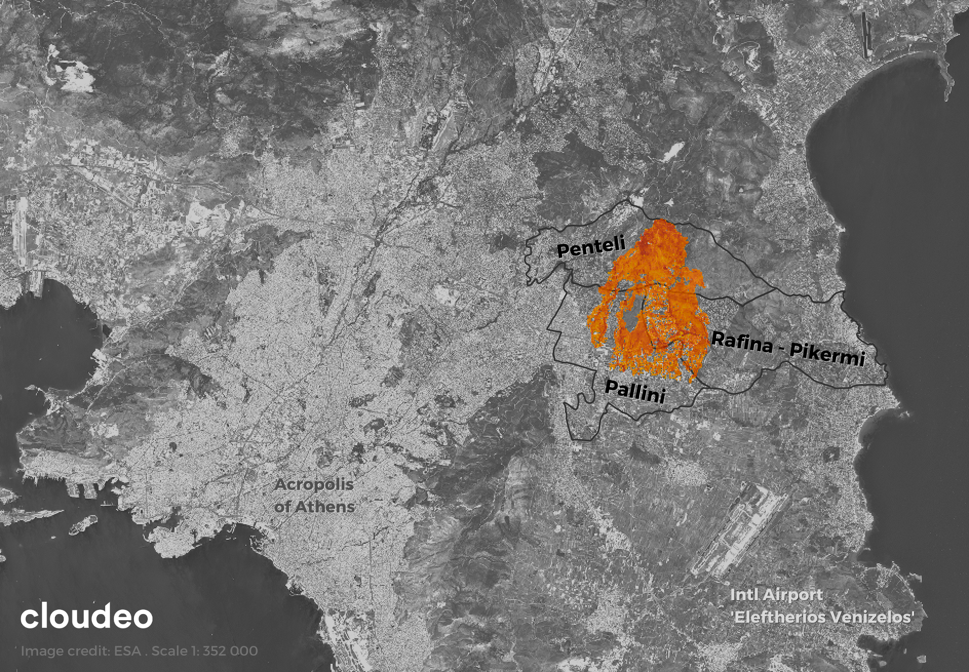
Cloudeo, in collaboration with Airbus Defence and Space, exploited the very high-resolution imagery of Pléiades Neo (30cm pixel size), to extract with more details the scar that was left behind by this extreme forest fire. In total, the estimated burnt scar is 2351 hectares, including private buildings and properties, and forest areas.
Get access to the brief report of the Mount Penteli forest fire and discover how you can take advantage of very high-resolution satellite imagery, like Pléiades Neo, to gain valuable insights after a forest fire event close to urban areas: