Marine ecosystems are subject to many direct human-caused pressures. Some have global implications, like warming water, which changes ocean currents and global climate; some are regional, like ocean acidification, overfishing, and invasive species; some are local, like pollution and beach erosion. These stressors, which are even more prevalent in the ocean, can have cumulative effects on marine ecosystems, which are the basis for what we now call the Blue Economy (which ranges from fishery and recreational uses to extraction. Their impact is expected to be even stronger in enclosed and semi-enclosed basins like the Mediterranean or the Gulf of Mexico, to name just two, where high population density and the impact of large-scale tourism flow compound the effect of other commercial maritime activities. Improved knowledge of the consequences of this confluence of stressors on marine biodiversity and ecosystem functioning is vital to our survival as a society and species.

Although the oceans make up 70% of the Earth's surface and 99% of its ecosystems and are home to 91% of all species, in-situ measurements and observations could so far only explore less than 5% of the world's oceans. Remote-sensing Earth Observation with high-resolution satellite imagery is irreplaceable for ocean monitoring and the Blue Economy that relies on it, providing insights into ecosystems and marine life for the fishing industry, measuring temperatures (essential for weather forecasting, for example), or monitoring shipping lanes and locating vessels. And very high-resolution satellite data can be combined with sparse in-situ observations (e.g., autonomous observation platforms—buoys, moorings, ships-of-opportunity) to create computational models; ultimately, this can provide an unprecedented capability to observe, understand, and anticipate marine events that impact maritime safety, security, and sustainability.
Remote sensing technologies present a wide variety of advantages, including a higher taxonomic resolution and the capability to provide rapidly – often in near real-time – information regarding broad geographic areas or large temporal scales. Technological advancement is evolving in two main directions: (i) innovative molecular approaches for rapid biodiversity assessment; and (ii) (optical) sensor systems, which allow us to operate and collect data over broad spatial and temporal scales. Methods able to combine both sets of affordances are thus highly desirable.
Thanks to Earth Observation systems and missions, there have been various improvements to applications such as:
Mapping of fishing zones
Forecasting algal blooms
Better forecasting of new areas accessible due to ice melting
Water depth, winds, waves, and current monitoring for renewable energies and ship routing
Forecasts of regional sea-level rise and storm surges
Monitoring and prevention of coastal erosion
Supporting environmental regulations and Marine Protected Areas (MPAs).
Optical, thermal, and radar images from airborne and satellite sensors offer many new opportunities for the direct monitoring of biodiversity, for observing patterns in the land and sea which relate directly to biodiversity, or for the provision of environmental data layers that are needed to build predictive models of species and habitat distributions.
Take the Sentinel mission, for example. Sentinel 1 is a C-band synthetic aperture radar (SAR) satellite with cloud-penetrating ability, delivering images in various modes and swaths related to marine and maritime needs, sea-ice extent oil-spill monitoring, and ship detection for maritime security. The way that radar waves bounce off objects helps determine intertidal and salt-marsh habitats' size and composition. 10-meter resolution optical images from Sentinel-2 of the coastal zone, as with Sentinel-1, will significantly enhance our ability to detect changes in intertidal and shallow subtidal habitats. Meanwhile, Sentinel-3 is designed for wide-field ocean color viewing, altimetry, and sea surface temperature. Sentinel-3 will continue the progress made by other ocean-viewing satellites such as SeaWiFS, MERIS, and MODIS. The use of remote sensing represents a cost-effective tool that complements conventional in situ samplings. The in-situ measurements are typically based on discrete data sets with limited spatial and temporal coverage, limiting the phytoplankton dynamics' analysis concerning human activities.
Scientifically qualified and regularly updated digital data help scientists protect the marine environment and biodiversity. Monitoring water quality, temperature, currents, salinity, sea ice, sea level, or wind; insights into biogeochemistry are essential for human well-being, sustainable aquaculture, oil and gas exploration, deep-sea mining, and marine renewable energy sectors are some of the applications where satellite and airborne data are used for environmental, climate remotely, and oceanographic research.
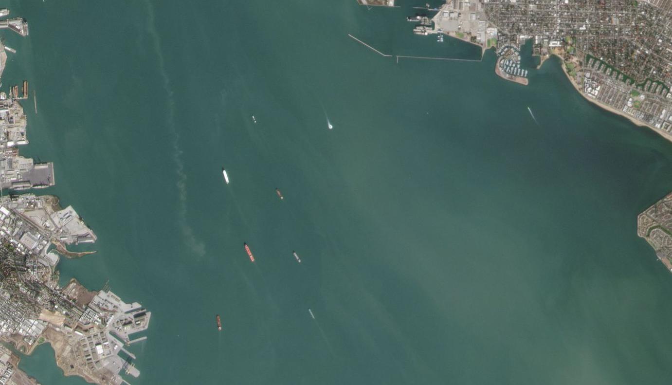
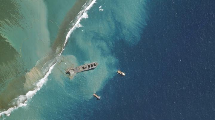
Satellite data users can develop high-resolution coastal models to manage and monitor coastal areas to manage better aquaculture farms and the sustainable exploitation of the ocean's living resources. EO data are essential to creating safer and more ecologically aware marine navigational maps, monitoring marine habitat and benthic ecosystems, at-risk coastal properties, or infrastructure assessment. They improve safety at sea and pollution response by providing oceanic parameters for pollutant drift forecasting like oil spills, vessel identification, illegal fishing detection, AIS data validation, coastal erosion detection, and algal blooms identification. Synthetic-aperture Radar (SAR) satellite data can locate ships in large-scale ocean areas; VHR optical satellite data help determine details such as vessel type and accurate measurements.
Copernicus Marine Service strives to provide critical indicators monitoring the changing environmental conditions in the context of climate change. Key variables help track the vital health signs of the ocean and changes in line with climate change: Knowing how much heat is stored in the sea, the ocean's pH, how fast the sea levels are rising, and sea ice is melting is essential to understanding the current state and changes in the sea and climate. This information is critical for assessing and confronting oceanic and atmospheric changes associated with global warming. These data can be used by scientists, decision-makers, environmental agencies, and the general public to measure our environmental directives' responses.
The ocean monitoring value chain covers many domains related to coastal and marine exploitation and preservation, like aquaculture, fisheries, water quality, and maritime transport. While this is still mainly the domain of users in the public sector, the increased importance of the Blue Economy has led to a significant increase in users from the private sector.
Interested in geospatial data and software that apply to marine and maritime applications?
Check them in cloudeo marketplace.
Cover Image: PlanetScope mission, Planet.