Earth Intelligence Data

https://www.cloudeo.group/web/image/product.template/182/image_1920?unique=45e7ccd
  • Service Provider​
  • Thematic Information
  • Features​ Provided
  • Access Mode​
  • Pricing Options
  • Pricing​
  • Free Trial
  • Delivery Time​
  • Compatible products
  • Mission
  • Sensor & Data Products
  • Data Format​
  • Spatial Resolution​
  • Spatial Coverage
  • Temporal Coverage
  • Temporal Resolution

This combination does not exist.


Provided by Spire


cloudeo Terms and Conditions

Access to environmental data in unprecedented detail, from Earth’s surface to near-space.

Interested in Spire's Earth Intelligence Data?

Fill out a form with all your requirements and we will contact you as soon as possible with a quote!

                Earth Intelligence Data

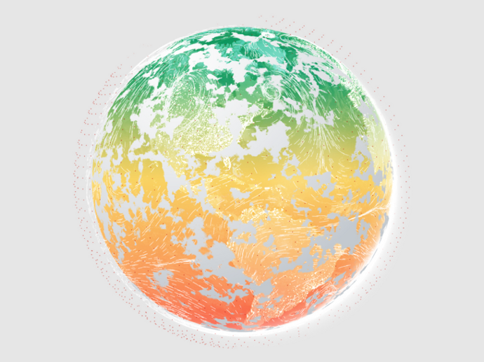
                Spire constantly collects rich and unique data sets about our planet’s surface and its atmospheric layers to provide a complete view of what’s happening on and around Earth. Their low-orbit satellites use radio frequency sensors to constantly gather new information, while predictive models distill complex environmental data into intelligent insights you can use to make business decisions, drive public initiatives, and anticipate future climate fluctuations.


                What kind of datasets are available through Spire's Earth Intelligence Data?

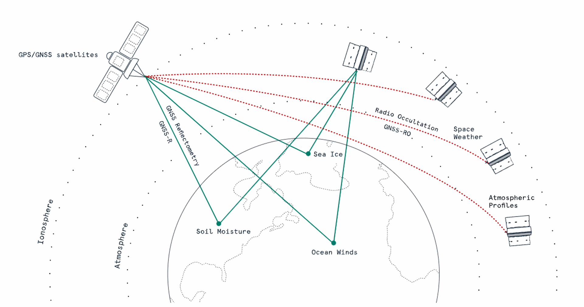
                • Surface data: Study Earth’s surface using GNSS scatterometry and precise altimetry (GNSS-R), to measure ocean wind speed, soil moisture, flood inundation, and sea ice.

                • Atmospheric data: Monitor our atmosphere with precise GNSS radio occultation (GNSS-RO) soundings to improve global weather forecasting accuracy.

                • Space weather data: Monitor the ionosphere using measurements of electron density and scintillation to augment GNSS accuracy, allowing you to prepare for and react to weather events in space.

                Specifically:

                Earth Intelligence data sets
                Data
                Data layers

                Earth’s surface

                GNSS reflectometry and precise altimetry (GNSS-R)
                Soil moisture
                Sea ice extent & classification (ice type)
                Sea Ice altimetry (under development)
                Surface water mapping – river, wetlands, flooding (under development)
                Ocean winds (under development)

                Atmospheric 

                GNSS-RO profiles for improved weather forecasts and accuracy
                Bending angle profiles
                Dry temperature profiles
                Refractivity profiles

                Space weather & space situational awareness

                GNSS-based ionospheric monitoring
                Total electron content (TEC) data
                Electron Density profile
                Ionospheric scintillation indices (ISI)
                Modeled ionospheric now and forecasts (under development)
                Precise orbit determination (POD)


                Need a sample to test the product before ordering?

                Protected by reCAPTCHA, opting in Newsletter, Privacy Policy applied. 

                Your sample request has been sent

                Our team will message you back as soon as possible in the provided email.

                Key features

                Rich, unique datasets harness GNSS signals of opportunity

                True global coverage with dense spatial and temporal resolution

                Collected from Spire's constellation of 100+ multifunctional satellites

                Quick access, easy to use

                Ensured format compatibility

                Resilient observations and continuous technology improvement

                Key applications

                Infrastructure

                Planning and Design

                Risk Assessment and Resilience Planning

                Maintenance and Asset Management

                Agriculture

                Crop Yield Analysis

                Risk Assessment and Insurance

                Climate Change Studies

                Maritime

                Vessel Routing and Navigation

                Port Operations and Planning

                Climate and Environmental Research

                Request quote

                Earth Intelligence Data
                Protected by reCAPTCHA,  I have read and accept the Privacy Policy

                People also viewed

                Do you have more questions about the product?

                We are here for you! Please contact us and we will come back to you shortly!

                Specifications for Earth Intelligence Data

                General Info
                Service Provider​ Spire
                Thematic Information Surface data; Atmospheric data; Space weather & space situational awareness data
                Features​ Provided Soil moisture; Sea ice extent and type; Profiles for improved weather forecasts and accuracy; Ionospheric monitoring
                Access Mode​ API
                Pricing Options Pre-paid; Subscription
                Pricing​ Per number of requests; Per amount of data retrieved
                Free Trial On demand
                Delivery Time​ Up to 5 business days
                Compatible products Standalone; SaaS
                Geodata Specs
                Mission Spire Satellite Constellation
                Sensor & Data Products GNSS; GNSS-RO
                Data Format​ NetCDF
                Spatial Resolution​ 12.5km
                Spatial Coverage Global
                Temporal Coverage Since 1990 (Soil moisture); Since 2020 (Sea ice)
                Temporal Resolution Daily (Soil moisture); Weekly (Sea ice)