Mapping and monitoring of agricultural areas are an ideal application for satellite image data as big areas can be easily covered in a very cost-efficient way.
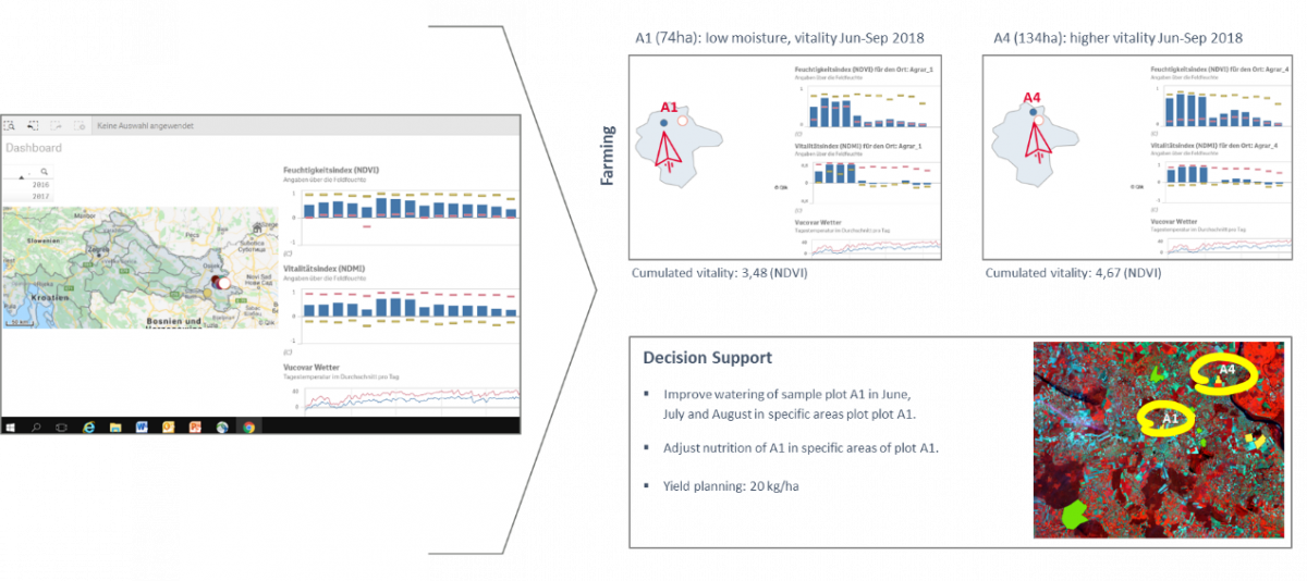
Today, it is essential for farmers not just to get data, which would increase their workload, but to get concrete, straight-to-the-point recommendations on what precisely to do on the field in terms of irrigation, fertilizing, and crop treatment which is remote sensing in precision farming.
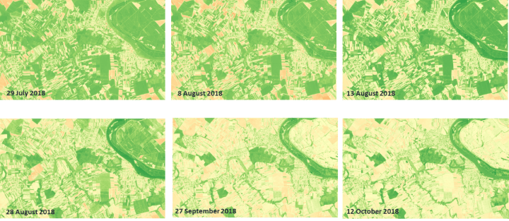
Visualizing what the human eye does not see
Mapping and monitoring agricultural areas are ideal for satellite image data as big areas can be easily covered in a very cost-efficient way. In particular, the advantages of multispectral remote sensing with spectral channels covering red-edge (690 to 730 nm), Near Infrared (NIR, 760 – 850 nm), and Short-Wave Infrared (SWIR, 1000 – 2.500 nm) bring a lot of benefits as they help to visualize effects that the human eye cannot see, such as vegetation vitality (intensity of the photosynthesis) as well as the water content of the vegetation/water stress.
A new boost through Sentinel satellite image data
With the introduction of Landsat data with 30 m spatial resolution in the 1980s, and especially with the launch of Sentinel 2 satellites with a revisiting time of 5 days and a spatial resolution of up to 10 meters, a significant prerequisite was achieved to perform highly efficient agricultural monitoring over vast areas. This can be supplemented by very-high-resolution satellite imagery, for example, for very detailed monitoring work on crops.
Satellite image data as input for cultivating crops
Earth observation data from platforms on satellites, aircraft, or unmanned aerial systems are essential for commercial agriculture monitoring and precision agriculture, where information regarding vegetation vitality (often also related to nitrogen content) and water content are usually ingested in irrigation systems or fertilizing devices. Furthermore, the acquired data are also the basis for harvest forecasts and precision farming.
Commercial and non-commercial applications
If this analysis is performed for whole regions and countries, it can play an essential role in determining the sales price of the crops – and on a non-commercial basis, provide valuable information regarding food security, for instance in Africa and Asia.
From data to information and recommendations
Today, it is essential for farmers not just to get data, which would increase their workload, but to get concrete, straight-to-the-point recommendations on what precisely to do on the field in terms of irrigation, fertilizing, and crop treatment which is remote sensing in precision farming.
Especially in highly industrial agricultural production, complex management and forecast systems are built up, including weather data, IOT soil moisture, nutrient content sensors, sensors for the detection of plant diseases, and simulations of the spread of plant diseases and bugs.