The rapid global transition towards renewable energy sources is driven by the need to address climate change and achieve a sustainable energy future. In this context, site planning plays a crucial role in the successful deployment of renewable energy projects.
Earth observation technologies, including satellite and drone imagery, and elevation data, have emerged as valuable tools in the site planning process for renewable energy installations. This includes solar farms, wind farms, and hydropower plants. By harnessing the power of earth observation, planners can gather essential information on factors such as solar irradiation, wind resources, hydrological conditions, terrain characteristics, and land cover. These insights enable decision-makers to identify optimal locations, maximize energy generation efficiency, and ensure the responsible use of resources.
In this article, we explore how earth observation technologies contribute to site planning in the renewable energy sector, highlighting their benefits and the key trends in solar, wind, and hydropower energy.
Renewable energy trends
The next decade holds immense promise for the renewable energy sector, as a range of trends and advancements are set to shape the industry. Solar power is poised for continued growth, benefiting from declining costs and supportive policies. With advancements in energy storage technologies, the integration of solar energy into smart grids and the deployment of energy storage solutions will further enhance its reliability and enable a smoother transition to a renewable future. Meanwhile, wind power is expected to experience accelerated deployment, driven by larger and more efficient turbines. The growth of onshore and offshore wind farms, coupled with emerging floating wind technology, will expand the capacity for clean energy generation and contribute to the diversification of renewable energy sources.
Moreover, we will witness a transformative shift towards electrification of transportation, with electric vehicles (EVs) taking center stage. This transition to EVs powered by renewable energy sources will significantly contribute to reducing greenhouse gas emissions from the transportation sector. Governments, automakers, and charging infrastructure providers are making substantial investments to support the adoption of EVs, driving the demand for renewable energy generation. Additionally, the growing focus on green hydrogen as an energy carrier holds great potential. With falling costs of renewable electricity and advancements in electrolysis technology, the production and utilization of green hydrogen are expected to witness significant growth, offering a versatile and sustainable solution for various sectors, including industry, energy storage, and transportation. The combination of these trends sets the stage for a more sustainable and cleaner energy future in the coming years.
Solar farm site assessment over Southern France
Site suitability assessment insights using the NEXTMap One™ elevation model and ancillary geospatial data.
Top 3 renewable energy sources
The top three renewable energy sources that are widely recognized for their potential and current contributions to the global energy mix are solar energy, wind energy, and hydropower.
Solar energy is a leading renewable energy source due to its vast availability and versatility. It harnesses the power of sunlight through photovoltaic (PV) panels or solar thermal systems to generate electricity or heat. Solar power offers significant advantages, such as being abundant, clean, and scalable. As solar technology continues to advance, the costs of solar panels have plummeted, making them increasingly cost-effective. Solar energy can be harnessed both at a utility scale, with large solar farms, and at a distributed scale, with rooftop installations on residential and commercial buildings. The growth of solar power installations around the world has been remarkable, contributing significantly to the global renewable energy capacity.
Wind energy is another dominant renewable energy source that has experienced rapid growth in recent years. It converts the kinetic energy of wind into electricity through wind turbines. Wind power has become increasingly cost-competitive with conventional energy sources, leading to the establishment of large-scale onshore and offshore wind farms. Offshore wind, in particular, has gained traction due to its higher wind speeds and reduced visual and noise impacts. The development of larger and more efficient wind turbine designs, along with favorable policies and declining costs, has propelled the expansion of wind power installations worldwide. Wind energy offers the advantage of being a clean and abundant resource, capable of delivering substantial amounts of electricity to meet growing energy demands.
Hydropower, generated from flowing water, is one of the oldest and most mature renewable energy sources. It accounts for a significant portion of global renewable energy capacity. Hydropower utilizes the energy of falling or flowing water to spin turbines, which, in turn, generate electricity. It offers advantages such as being highly reliable, dispatchable, and capable of providing baseload power. Large-scale hydropower plants, including dams and reservoirs, have been instrumental in supplying electricity to countries around the world. However, small-scale hydropower systems, such as run-of-river or micro-hydropower, are also gaining popularity, particularly in rural areas with access to water resources. The challenges associated with the environmental impact and displacement of local communities have led to an increased focus on sustainable hydropower practices, including fish passage systems and ecological flow regimes.
Site planning for solar farms using earth observation
Site planning for solar farms using earth observation technologies offers significant advantages in identifying optimal locations and maximizing the efficiency of solar energy generation. Solar irradiation levels, shading analysis, land cover classification, and topography are some factors that influence site selection and can be retrieved from earth observation data, including satellite imagery and elevation products.
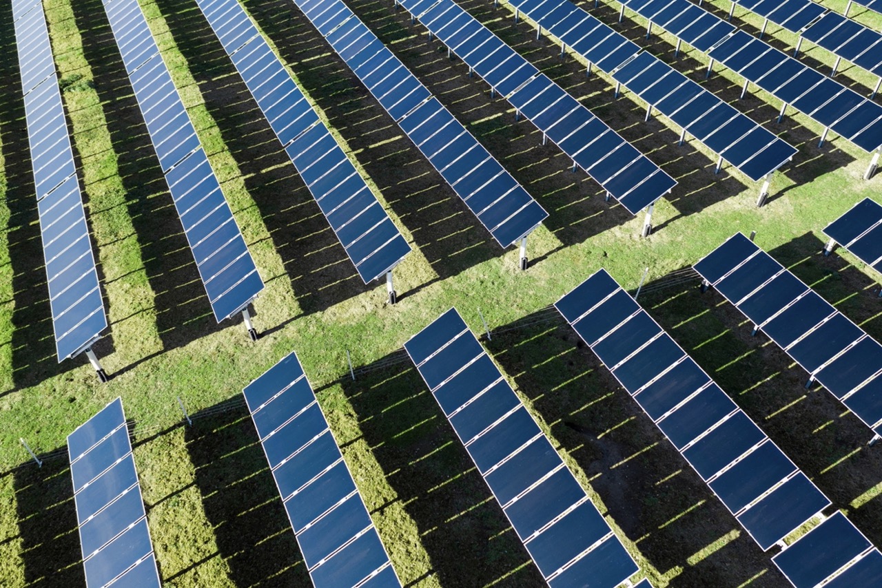
Specifically, satellite imagery can provide very high-resolution and up-to-date information on land use, allowing planners to assess the suitability of different land parcels or detect restricted zones. Remote sensing techniques can help determine the terrain characteristics, such as slope and aspect, which impact solar panel orientation and energy yield. The solar potential and the solar resource availability can also be extracted using Digital Surface Models (DSM), with which minimal obstructions, such as buildings or trees that may cast shadows on solar panels can be determined. So these data can effectively contribute to the analyses to identify the most suitable locations for solar farms based on multiple criteria, such as solar resource potential, land availability, proximity to existing infrastructure, and environmental considerations.
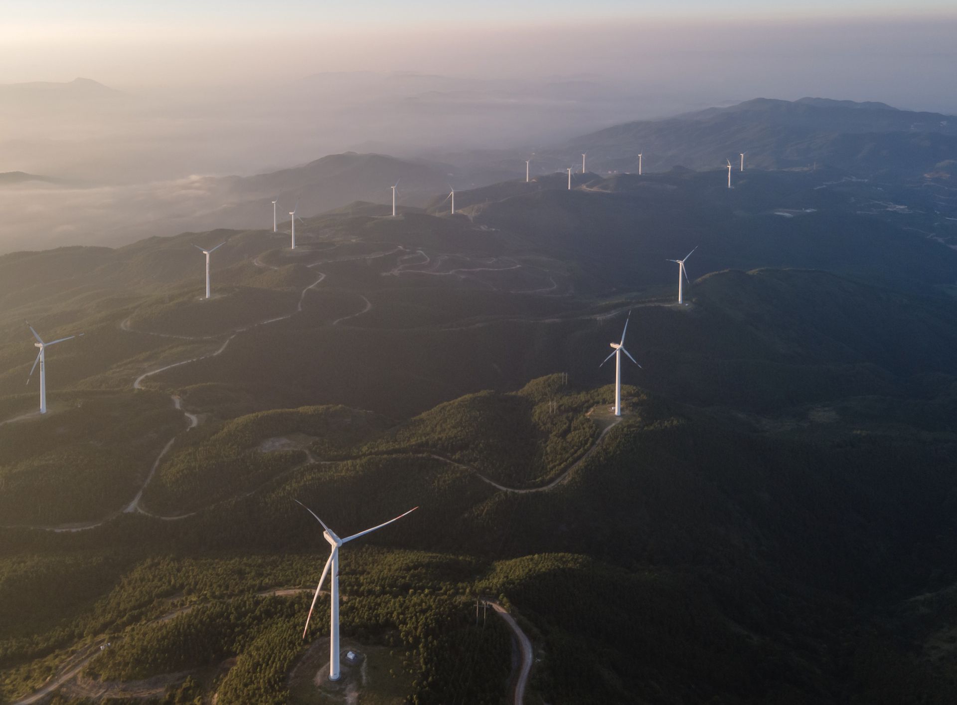
Site planning for wind farms using earth observation
Site planning for wind farms using earth observation technologies is a powerful approach that enables the identification of suitable locations and the optimization of wind energy generation. Earth observation data, including satellite imagery, elevation, and LiDAR (Light Detection and Ranging), can provide valuable information on various factors that influence site selection for wind farms. This includes wind resource assessment, wind speed and direction, terrain analysis, and proximity to existing infrastructure. By leveraging these data sources, planners can assess the wind potential of different areas and identify sites with high wind resource availability and favorable wind conditions for efficient energy production.
Satellite imagery can provide detailed information on land cover, allowing planners to identify areas with minimal obstructions such as buildings or trees that can impede wind flow. Remote sensing techniques, such as LiDAR, can be used to measure wind speeds and gather precise data on wind patterns at different altitudes. By integrating earth observation data with advanced wind resource assessment models and geographical information systems (GIS), areas with optimal wind conditions can effectively be identified, considering factors such as wind speed, turbulence, and wind direction, thus maximizing the energy output and efficiency of the wind farm.
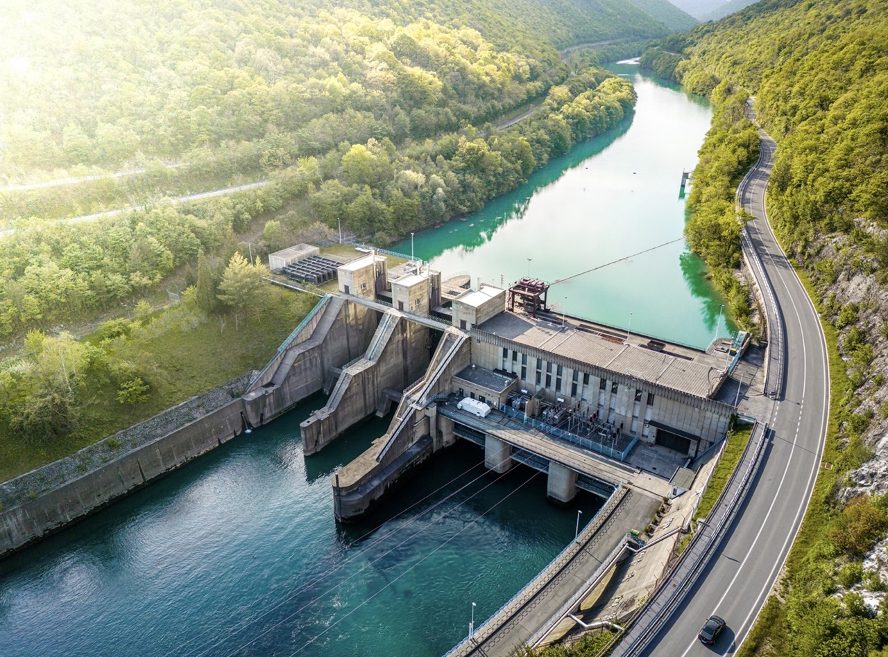
Site planning for hydropower plants using earth observation
Earth observation data can provide critical information on various factors that influence site selection for hydropower plants. This includes hydrological analysis, river flow rates, elevation data, and topographic mapping.
Satellite imagery can provide valuable insights into the surrounding terrain and land cover, enabling planners to identify areas with favorable topography for dam construction and water storage. Geospatial techniques, such as radar altimetry and hydrological modeling, can be used to monitor river flows, analyze water volume, and assess the hydrological characteristics of the site. By integrating earth observation data with hydrological models into a geographic information system (GIS), planners can make informed decisions about site selection, taking into account factors such as water availability, river morphology, environmental impacts, and potential downstream effects, to ensure the optimal utilization of water resources for hydropower generation. Thus, the water resource potential of different areas can be efficiently assessed and sites with suitable hydrological conditions and sufficient water availability for hydropower generation can be easily and effortlessly identified, with no need for site inspections.
Conclusion
In conclusion, the renewable energy sector is experiencing significant growth and transformation driven by technological advancements, policy support, and increasing environmental consciousness. Solar energy, wind energy, and hydropower are the top three renewable energy sources that are leading the way in the transition to a sustainable energy future. Solar energy, with its abundant potential and falling costs, is witnessing widespread adoption. Wind energy is rapidly expanding, both onshore and offshore, benefiting from improved turbine technology and favorable regulatory frameworks. Hydropower continues to be a reliable and established renewable energy source.
In the site planning process for solar farms, wind farms, and hydropower plants, earth observation data plays a critical role. Through satellite imagery, elevation data, and environmental models, valuable information is gathered on solar irradiation, wind resources, hydrological conditions, terrain characteristics, and land cover, assisting in the identification of optimal locations for renewable energy installations, maximizing energy generation efficiency, and ensuring the responsible use of resources. In this way, earth observation data empowers planners and decision-makers to make informed choices, considering factors like resource potential, environmental impact, and infrastructure compatibility. Thus, the renewable energy industry can maximize energy generation efficiency, and contribute to the transition towards a sustainable and low-carbon future.
Need a custom solution to support site assessment for a renewable energy project?
Tell us about it. Fill out the form below with all the necessary information. Our sales team will gather the most suitable satellite datasets and contact you as soon as possible.