PlanetObserver Online Map Services

https://www.cloudeo.group/web/image/product.template/187/image_1920?unique=03741ac
  • Service Provider​
  • Thematic Information
  • Service Option​s
  • Features​ Provided
  • Access Mode​
  • Pricing Options
  • Pricing​
  • Free Trial
  • Delivery Time​
  • Compatible products
  • Mission
  • Data Processing Level
  • Spatial Resolution​
  • Spatial Coverage
  • Temporal Coverage

1,238.00 € 1,238.00 € 1238.0 EUR

1,258.00 €

This combination does not exist.

Add to Cart

Provided by PlanetObserver


cloudeo Terms and Conditions

Regular

from
1238
/year

  • 1 Concurrent User
  • Access to either PlanetSAT, PlanetDEM, or both
  • WMTS, WMS, WCS
  • Connection to ArcGIS, QGIS
  • Free Annual Updates
  • User Guide
  • Email Support by PlanetObserver

Heavy

from

2870
/year

    • 5 Concurrent Users
    • Access to either PlanetSAT, PlanetDEM, or both
    • WMTS, WMS, WCS
    • Connection to ArcGIS, QGIS
    • Free Annual Updates
    • User Guide
    • Email Support by PlanetObserver

Scripting

from

3830
/year

    • 10 Concurrent Users
    • Access to either PlanetSAT, PlanetDEM, or both
    • WMTS, WMS, WCS
    • Connection to ArcGIS, QGIS
    • Free Annual Updates
    • User Guide
    • Email Support by PlanetObserver under 24h

Custom


Contact us


    • 10+ Concurrent Users
    • Access to either PlanetSAT, PlanetDEM, or both
    • WMTS, WMS, WCS
    • Connection to ArcGIS, QGIS
    • Free Annual Updates
    • User Guide
    • Email Support by PlanetObserver under 24h

Subscription-based online map services that deliver immediate streaming access to fresh and global basemap and elevation data - save the costs of handling, storing and updating your data products internally.

        PlanetObserver Online Map Services

        Experience seamless and efficient access to high-quality global mapping data, consistently updated to meet your needs!

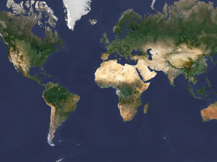
        PlanetObserver Online Map Services (OMS) is a geospatial data and satellite imagery platform that provides satellite images and Earth observation solutions to organizations, governments and businesses. With more than three decades of experience in the field, it is now an established platform that with constant innovation and growth has managed to provide high-accuracy products to its buyers.


        PlanetObserver OMS feature the PlanetSAT Global 10m imagery basemap and the PlanetDEM 30m Digital Surface Model, ensuring you have the latest geospatial information at your fingertips! Subscription-based online map services are offered, providing immediate streaming access to fresh global data, featuring either georeferenced satellite imagery, elevation basemaps, or both. And with streaming services included, you will be able to effortlessly explore map data at various scales, from worldwide coverage down to local areas.

        Furthermore, integrating PlanetObserver Online Map Services with GIS applications, such as ArcGIS and QGIS, is simplified through the use of OGC standard protocols and APIs. Start combining the global imagery and elevation data provided by PlanetObserver with your proprietary content and analysis environments to unlock an array of possibilities!

        Key features

        Quick and easy streaming access to quality global mapping content

        Updated annually to incorporate new images and stay current

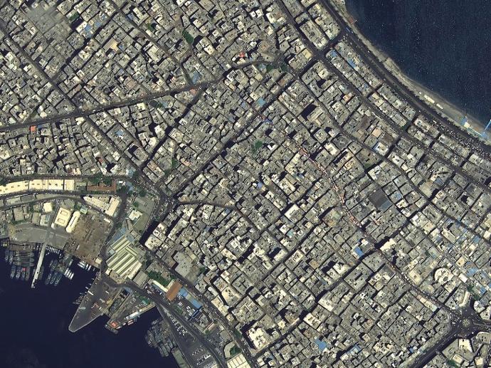
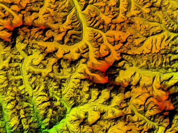
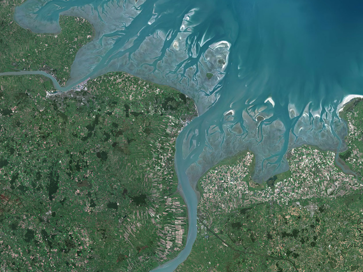
        Access to PlanetSAT Global imagery basemap, PlanetDEM  Digital Surface Model, or both

        Access any AOI you need at any time

        Direct integration in your GIS applications, visualization, and mapping platforms

        Product data ready to be used without any further processing

        Key applications

        Aviation

        Flight planning

        Real-time visualization & navigation solutions

        Flight assistant applications

        Infrastructure

        High-quality basemap for visual reference

        Land use and change detection 

        Urban mapping

        Energy

        Natural Resource Management

        Water Administration

        Oil and Gas Distribution Mapping

        FAQs

        How do I access the online map services?

        Access the web services through your own web browser, stream the data through GIS applications such as ArcGIS Desktop, QGIS, or your business application, based on standardized OGC WMS/WMTS/WCS services, or connect your solution via API.

        How often is new content added to the web services?

        PlanetSAT Global imagery basemap is updated on a yearly basis. When new content is added to the package(s) to which you are subscribed, you will directly have access to this content without any additional cost.

        Contact us to benefit from a 14-day free trial of PlanetObserver Online Map Services.

        We offer a 10% price reduction for the subscription to both PlanetSAT and PlanetDEM datasets.

        Request quote

        Protected by reCAPTCHA,  I have read and accept the Privacy Policy

        People also viewed

        Do you have more questions about the product?

        We are here for you! Please contact us and we will come back to you shortly!

        Specifications for PlanetObserver Online Map Services

        General Info
        Service Option​s Regular or Heavy or Scripting
        Features​ Provided PlanetSAT or PlanetDEM or PlanetSAT and PlanetDEM
        Service Provider​ PlanetObserver
        Thematic Information Global imagery basemap; Surface elevation
        Access Mode​ Streaming; WMTS/WMS; WCS
        Pricing Options Pre-paid
        Pricing​ Per package / Subscription period
        Free Trial On demand
        Delivery Time​ Up to 5 business days
        Compatible products Standalone; SaaS
        Geodata Specs
        Mission Sentinel-2; Landsat 7; Landsat 8; ALOS
        Data Processing Level Ortho; Cloud cover less than 10%
        Spatial Resolution​ 10m (Imagery basemap); 30m (Elevation); 50cm (On demand)
        Spatial Coverage Global incl. Antarctica
        Temporal Coverage Latest available