Following a prolonged period of severe drought, the Italian region of Emilia-Romagna was hit by heavy rains between May 2nd and 3rd, 2023. The provinces of Bologna and Ravenna experienced particularly heavy rainfall, leading to overflowing rivers in Romagna. This resulted in widespread damage in the plains and sadly claimed the lives of two individuals.
As a response to the situation, Cloudeo, in collaboration with Globhe, utilized ultra-high-resolution drone imagery with pixel sizes as small as 1 cm to extract detailed information about the scars left behind on specific crop fields by this extreme flood event. The drone was specifically ordered to acquire multispectral imagery, capturing Red, Near-infrared / NIR, Red Edge, and Green bands.
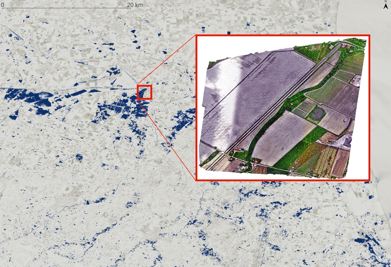
Flood water extent* over the Emilia-Romagna region as extracted from Sentinel-2 satellite imagery on 23rd May by the Cloudeo team. The study area where the drone imagery was acquired is within the red square.
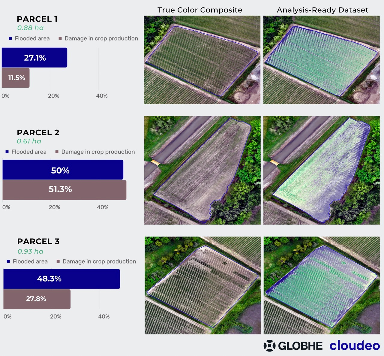
Crop damage assessment
Cloudeo team processed and analyzed the multispectral drone data that were provided by Globhe. The analysis focused on three specified by the user parcels, and the results answer the questions:
What is the level of damage caused by the flooding?
What is an estimation of the production loss due to the damage?
In the analysis-ready dataset, the unaffected crops per parcel are visualized with green colors, and the flooded areas (damages) are symbolized with blue color:
Interested in Globhe products?
Get up to 1-centimeter resolution drone data, ideal for applications that require extreme level of detail and quality!
The use of drone data in combination with satellite imagery provides valuable insights for accurate crop damage assessment, specifically in scenarios such as flooding events.
The ultra-high spatial resolution of 1cm provided by drones enables the detection of subtle changes in vegetation health, allowing for a precise understanding of the impact of flooding on crops. Not only do they enable the mapping of flooded zones, but also they provide an estimation of production loss at the parcel level with great precision.
Moreover, the timely availability of drone data is crucial for efficient damage assessment. Rapid deployment of drones enables faster response and mitigation efforts.
This information empowers farmers, farm associations, as well as insurers, and governmental institutions to make informed decisions, act faster, and implement effective strategies to minimize the impact of crop damage caused by an upcoming flooding event.
Did you like what you read? Download the Brief Report for the crop damage assessment over a selected area of the Emilia-Romagna region, taking advantage of the ultra-high-resolution drone data from Globhe: