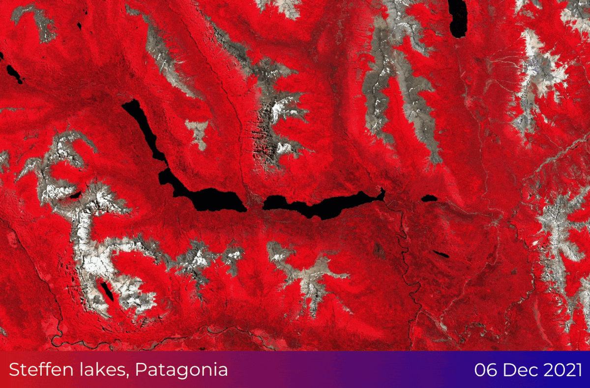
Since December 2021, several provinces across Argentina have been devastated by forest fires due to climate change. Fires destroyed also areas within Patagonia, in the southern Argentine region close to Chile, a region of which was in the broader area of Steffen lakes.
With the assistance of satellite imagery and GIS technology, such events can be monitored, almost real-time, and their aftermath can be easily evaluated. For large-scale events, like the forest fires in Argentina, high-resolution satellite imagery (10 - 100m spatial resolution) with a frequent revisit time can extract meaningful information to the local and national authorities, such as:
burnt area estimation on a local and regional scale
how the fire was developed across the area
detection of fire spots
estimation of damaged private property for insurance purposes
UsingSentinel Hub, our team gathered cloud-free satellite acquisitions from the Copernicus Sentinel-2 sensor and created the following timelapse of the forest fire expansion in the broader area of Steffen lakes in Patagonia.
Photointerpretation
Healthy vegetation and forest areas are represented with red color. Urban areas and regions covered with bare soil are visualized with light brown color, whereas snow is represented with white color (it can be easily distinguished on the mountain peaks!).
This false-color visualization derived from multispectral satellite images enhances the distinction between healthy and destroyed vegetation caused by events like wildfires and floods: healthy vegetation is viewed as light red, whereas damaged areas as dark brown, almost black.
Analysis
The acquisition dates of the Copernicus Sentinel-2 images cover approximately 1.5 months and are the 6th and 16th of December 2021, and the 10th and 25th of January 2022.
In order to extract an estimation of the burnt area, our tech team employed the Normalized Burned Ratio Index (NBRI). This index is used by the scientific community to estimate the severity of fires, mainly in forested and densely vegetated areas. NBRI takes advantage of the near-infrared and shortwave-infrared spectral bands of satellite imagery, which are sensitive to vegetation changes, to detect burned areas and monitor the recovery of the ecosystem (interested in more Earth Observation indices? Visit this blog post from our partner, GEO University).
This can be viewed from its formula for Sentinel-2 used in the analysis is the following:

After the calculation of the NBRI for each date, our team calculated the dNBRI: the difference between each date of the sequence. That is:
dNBRI1: between the 6th and 16th of December 2021
dNBRI2: between the 16th of December 2021 and 10th of January 2022
dNBRI3: between the 10th and 25th of January 2022
The result is shown in the following figure:
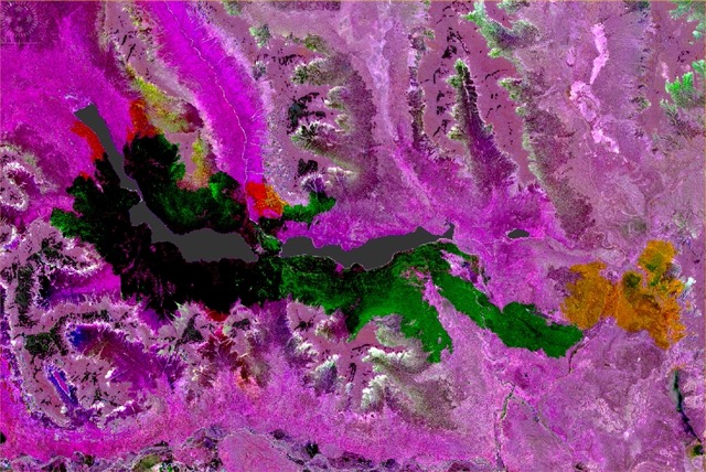
In this analysis, in black, there are the areas that were burnt since the beginning of the forest fire. In green are the areas from which the fire passed between the 16th of December 2021 and the 10th of January 2022, and yellow and red are the areas that appear as burnt during the 10th and 25th of January 2022.
The total estimated area that was burnt during this event is calculated to be approximately 6720 hectares.
Outcome
Indeed, remote sensing and geospatial technologies can assist in fire monitoring applications. Experts in forestry, decision-makers in the government, insurers, and brokers can gain valuable insights on the location of the fire spots, the direction of fire expansion, as well as if there were any properties that were seriously affected by the fire event, when also satellite imagery is combined with other geospatial datasets related to cadastre, buildings, and meteorological conditions during the specific period.
But essential information can also be provided to those that need to act proactively, like the firefighters. Using as input the elevation model of the area where a fire is spotted, predictions on the fire expansion can be extracted and be provided near-real-time, to minimize the size of the damage; and more importantly, in cases when human lives and are being threatened.
