The forest fire that swept through northeastern Greece in Evros has ravaged an expanse of land spanning more than 80,000 hectares of land, as of August 28th, as reported by the Copernicus Emergency Management Service of the European Union.
The wildfire started on August 19th near Alexandroupolis and spread to Evros region. It has been recognized as the largest wildfire in terms of area in the last 21 years in Greece (METEO unit of the National Observatory of Athens). Sadly, it caused the deaths of at least 20 people, making it the deadliest fire in Europe this summer. Strong winds and hot weather made the fire grow fast, destroying a significant amount of natural environment, including Natura 2000 protected areas, and many homes.
One year ago, the area faced another massive forest fire in the eastern part of the front, destroying over 4,000 hectares of forest at the Dadia National Park in Evros, a Natura 2000 site. Strong winds, low humidity, and high temperatures contributed to the spread of the fire.
The following timelapse shows the devastated areas of these two large forest fires in the Evros region, Greece, using Copernicus Sentinel-2-Satellitenbildern und der Sentinel Hub Plattform:
The two forest fire events:
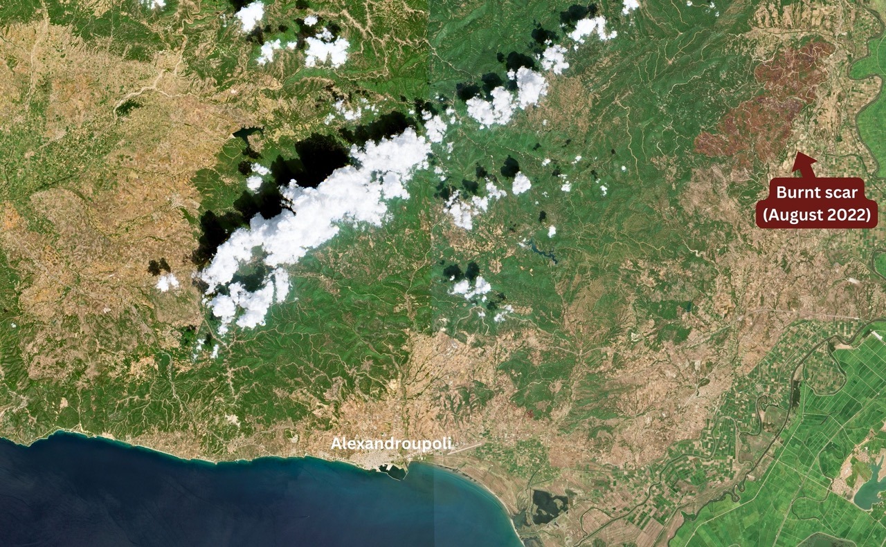
On 20-07-2022, a forest fire destroyed a forest area part of the Dadia National Park in Evros, a Natura 2000 site, northeast of Alexandroupoli, Greece. The aftermath of the blaze is visible as a dark brown area in a Sentinel-2 image captured on August 28th, 2022.
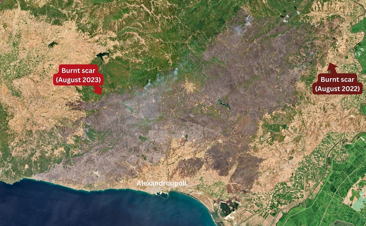
On 28-08-2023, one year later, the extensive burn zone of the recent massive wildfire is distinct from space. The image captured by Sentinel-2 shows not only the scorched expanse but also the smoke coming from the firefront, along with the remaining evidence of the previously charred landscape - all in striking detail.
These consecutive fire events underscore the urgent need for comprehensive forest management strategies and heightened awareness about preventing such disasters. The impacts of these fires are not only ecological but also deeply affect the local communities, wildlife, and the overall environment. It's imperative that we collectively address these challenges and work towards safeguarding our natural heritage.
Fernerkundungs- und Geodaten-Technologien können bei der Brandüberwachung helfen. Forstexperten, staatliche Entscheidungsträger, Versicherer und Makler können wertvolle Erkenntnisse über die Lage der Brandherde, die Richtung der Brandausbreitung und darüber gewinnen, ob Grundstücke durch das Brandereignis stark in Mitleidenschaft gezogen wurden.
Bildnachweis mit Dank an die European Space Agency - ESA Copernicus Programm.
Erhalten Sie multispektrale Satellitenbilder für forstwirtschaftliche Anwendungen
Erfahren Sie mehr über Satellitenbilder mit einer räumlichen Auflösung von bis zu 30 cm und sparen Sie Zeit und Geld!