In recent years, the world of Earth observation has witnessed a remarkable transformation. Unmanned Aerial Vehicles (UAVs) have emerged as game-changers, offering cost-effective, highly precise, and widely accessible imagery for both commercial and personal purposes. The agricultural sector, in particular, has experienced a significant uptick in the use of drones, providing a compelling alternative to traditional satellite-based remote sensing.
But what if we told you there's a way to harness the strengths of both methods for even more effective results? In this blog article, we'll delve into the exciting realm of combining UAV-captured images and satellite imagery to unlock new possibilities in Earth observation. Let's explore the future of this dynamic synergy.
The Role of Drone Imagery
As we've previously highlighted, opting for drones in remote sensing applications often overshadows traditional satellite imagery. The reasons behind this preference go beyond cost considerations. UAVs offer an incredibly user-friendly alternative, capable of delivering highly detailed images perfectly suited for missions requiring high precision. When an ultra-high level of accuracy is required, satellite images fall short of delivering the level of detail that drones can provide. Another compelling advantage of UAVs is their resilience to atmospheric interference, particularly cloud cover. Thanks to their lower flight altitude, clouds have far less impact on drone flights compared to their satellite counterparts.
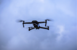
In the modern landscape of Earth observation, we have two primary types of UAVs at our disposal. The first is the fixed-wing drone, closely resembling miniature aircraft. The second, and often preferred choice for remote sensing, is rotary drones. What sets rotary drones apart is their remarkable ability to hover in place. This unique capability extends the valuable time for sensors to capture images, making them the go-to choice for remote sensing missions demanding precision and efficiency.

Agriculture has witnessed a profound revolution with the adoption of drones. Their affordability and user-friendly nature have opened a world of possibilities for surveyors and farmers in various agricultural applications.
One of the standout applications is land mapping and crop classification, a remote sensing technique that involves classifying plants, trees, and soil with similar spectral reflectance characteristics. Achieving this involves the creation of classifiers, whether manually or through automated methods. Images with finer details allow surveyors and classifiers to distinguish objects more effectively. For instance, an image that clearly distinguishes between two types of crops facilitates the mapping process and prevents crops from getting mixed up in future field surveys. Drones, with their low-altitude flight capabilities and extended capture times, excel in producing ultra-high-resolution images for this purpose.
Soil monitoring is another area where the very high-resolution images captured by UAVs help in the study of soil erosion patterns. These high-resolution images enable the modeling of biophysical attributes of crops on multiple scales, be it at the farm, crop, or leaf level.

The study of crop health is something that precise agriculture heavily invests in. Processing acquired images, whether by sensors capturing visible light to detect signs of crop disease or plant growth or employing multi-spectral images to analyze spectral regimes (visible, near-infrared, shortwave infrared) for insights into crop growth and health, offers valuable data. When it comes to mapping plants in crop fields accurately, UAVs are the best option, given their ability to capture images with a pixel size smaller than 2-5 cm (about half the length of the long edge of a credit card).
Precise agriculture is all about optimizing crop field management. By mounting UAVs with thermal or multispectral sensors, farmers can determine the optimal water levels required for their soil, provided the necessary image processing is carried out. Furthermore, the high spatial resolution of UAV images makes it possible to perform complex calculations, enabling various methods and parameters to estimate crop yields for diverse crop types.
Ένας ολοκληρωμένος οδηγός για τα προϊόντα GLOBHE και τις εφαρμογές τους
Ξεκλειδώνοντας τις δυνατότητες της τεχνολογίας drone, από το LiDAR έως τους θερμικούς χάρτες.
The Satellite Advantage
While we've discussed the advantages of UAV aerial photography in agriculture, it's crucial to acknowledge that the use of satellite-acquired imagery remains a valuable and contemporary practice. There are instances where satellite images surpass drones in utility. For instance, in predicting precipitation, satellites play a pivotal role, allowing for timely and cost-effective crop irrigation scheduling, preventing waterlogging, and conserving water resources, especially in drought-prone regions.
Satellites operate autonomously, eliminating the need for constant guidance. In addition, satellites have the freedom of unhindered flight routes, which can contradict the varying and sometimes stringent drone flight regulations in different countries. The frequency of satellite imagery is another merit. Landsat-8 offers a revisit frequency of 16 days, while Sentinel-2 boasts a 5-day frequency. This frequent data availability is particularly beneficial when creating time-progress-based maps.
Satellite imagery's most significant advantage lies in its coverage area. Modern satellites provide satisfactory resolution and can span areas spanning hundreds of kilometers. If high spatial resolution is unnecessary, the cost of using such images can be minimal or even free. Sentinel and Landsat missions offer zero-cost imagery. Alternatively, companies like Airbus provide commercial satellite data through their Pléiades, SPOT, and TerraSAR-X satellite constellations, delivering optical, elevation, and radar imagery with various spatial resolutions. Planet provides multispectral satellite imagery through their PlanetScope, SkySat, and RapidEye constellations, reaching up to 70 cm of spatial resolution. Satellogic’s multispectral cameras collect sub-meter imagery data at 70 cm at an altitude of around 475 km with its Aleph-1 constellation.
While we've previously explored numerous applications where drone imagery can shine, it's important to emphasize that satellites can be equally effective in many of these cases. The choice between the two methods hinges on the user's specific needs for detail and accuracy. It's a misconception to believe that one must exclusively employ either satellites or UAVs for a given application. True optimization comes from harnessing the strengths of both satellite and UAV imagery in a complementary manner. This can be achieved through various methods, tailored to each specific case and its unique requirements.
Εκτίμηση ζημιών στις καλλιέργειες πάνω από το Borgo Serraglio, Ιταλία
Πώς οι πολυφασματικές εικόνες υπερ-υψηλής ανάλυσης από drone μπορούν να βοηθήσουν στη λεπτομερή εξαγωγή των ζημιών σε επίπεδο αγροτεμαχίου που άφησε πίσω του ένα πλημμυρικό γεγονός.
Benefits of Crop Management
The fusion of satellite imagery and drone data provides an unprecedented level of precision in crop management. As already mentioned, satellite images offer a bird's-eye view of the entire agricultural area, while drones soar closer to the ground, capturing fine-grained, localized information. By harmonizing these data sources, farmers and agronomists can make laser-focused decisions regarding irrigation, fertilization, and pest control, tailored to the unique needs of different sections of their fields.
When it comes to remote field monitoring, satellite imagery is a powerful tool for assessing extensive fields remotely. It allows farmers to keep a watchful eye over vast agricultural landscapes. When specific issues surface in the satellite images, drones can be deployed for a closer look. This dynamic synergy minimizes the need for laborious physical inspections and ensures that potential problems are addressed promptly.
Agricultural seasons are a dynamic journey, marked by growth stages, potential threats, and ever-changing weather patterns. Satellite images provide ongoing updates, giving a comprehensive view of the entire growing season. When specific concerns arise, drones can be deployed for on-demand, high-resolution data collection. Drones armed with specialized sensors act as vigilant sentinels over the fields. Their ability to capture detailed imagery makes it easier to identify the early signs of diseases or pest infestations. By detecting issues in their infancy, farmers can take swift action to prevent the spread of diseases and minimize crop damage. This early detection not only safeguards crop health but also reduces the need for costly and environmentally harmful interventions.
The fusion of satellite imagery with drone data is revolutionizing crop management. It offers precision, timely insights, and efficient resource allocation, making farming more sustainable and productive. This powerful combination is the way forward, redefining the future of agriculture.
Need ultra-high resolution imagery from above?
Drone data is your solution. Check Globhe's drone imagery products and services and order your imagery now.
Συμπέρασμα
In conclusion, the realm of Earth observation in agriculture has witnessed remarkable advancements both in satellite technology and UAVs. While satellites have made significant strides in the agricultural sector over the past decades, UAVs have equally emerged as powerful tools in remote sensing. The choice between using data from drones exclusively or combining data from both satellites and UAVs hinges on the specific requirements of the task at hand.
What is abundantly clear is that the accessibility and affordability of data acquisition and processing have significantly improved. UAVs play a pivotal role in capturing intricate details, from individual crops to the detection of diseases, waterlogging, and weed issues. This micro-level data collection seamlessly integrates with broader-scale insights provided by satellites, creating a powerful synergy that enhances agricultural research and applications.
The message is clear: the integration of satellite and UAV data is the future of precision agriculture, offering tailored solutions that meet the unique demands of each task. As technology continues to evolve, it is an exciting time for the agricultural industry, as these advancements pave the way for more efficient, sustainable, and productive practices in the field.
Χρειάζεστε μια προσαρμοσμένη λύση για το έργο σας;
Πείτε μας γι' αυτό. Συμπληρώστε την παρακάτω φόρμα με όλες τις απαραίτητες πληροφορίες. Η ομάδα πωλήσεών μας θα συγκεντρώσει τις καταλληλότερες εικόνες drone χωρικής ανάλυσης έως και 1 cm και θα επικοινωνήσει μαζί σας το συντομότερο δυνατό.