Pléiades Neo
Pléiades Neo is the most advanced optical constellation of Airbus, with four identical 30cm resolution satellites with ultimate reactivity. Entirely funded, manufactured, owned, and operated by Airbus, Pléiades Neo is a breakthrough in the Earth Observation domain.
Its sensors capture Deep Blue, Blue, Green, Red, Red Edge, and Near-Infrared bands, at resolutions of 30 cm for Panchromatic, and 1.2m for Multispectral.
Offering an ideal trade-off between coverage, resolution, and speed, Pléiades Neo products are especially useful for applications in defense, civil protection, hazard management, urban mapping, precision agriculture, and network and infrastructure administration.
Apart from Archive imagery, with Airbus One Tasking you can order Pléiades Neo imagery on specific dates you need, over the area of interest of your choice! Three plans are available:
Tasking OnePlan, with which you select your timeframes, dates, and preferred acquisition parameters, and our team ensure you receive the right qualified coverage, perfectly matching your project milestones.
Tasking OneNow, with which you obtain the information you need in the shortest timeframe. When immediate imagery is required, our satellites can be tasked to deliver valuable insights in the shortest possible timeframe.
Tasking OneDay, with which you obtain the imagery you need on a pre-specified acquisition day. When you need imagery on a specific day, our satellites can be tasked with the highest priority to deliver the insight you need. 24 hours before your acquisition date, you receive a weather forecast to let you confirm, postpone or cancel your request at no cost.
In this way, you can be provided with answers and support in any situation exactly when and where you need it: from the most basic map update up to emergency response, land use analysis, mission planning, or frequent insights through reliable monitoring.
Need a sample to test the product before ordering?
Some general information for Pléiades Neo Constellation:
Launch | Pléiades Neo 3: April 28, 2021Pléiades Neo 4: August 16, 2021Pléiades Neo 5: in 2022Pléiades Neo 6: in 2022 |
Orbit | Sun-synchronous 10:30 AM descending node 620 km altitude |
Spectral bands | Panchromatic, Deep Blue, Blue, Green, Red, Red Edge, Near Infrared |
| Spatial resolution | Panchromatic @ 0.3 m; Multispectral @ 1.2 m |
| Radiometric resolution | 12 bits per pixel |
| Geometric precision | 3.5 m CE90 |
| Revisit time | Daily anywhere (30° off-Nadir) Twice daily anywhere (46° off-Nadir) |
And some technical specifications related to the ordering process:
Imagery type | ||||||||||||
| ||||||||||||
Geometric processing | ||||||||||||
| ||||||||||||
| Radiometric processing | ||||||||||||
| ||||||||||||
| Band selection | ||||||||||||
|
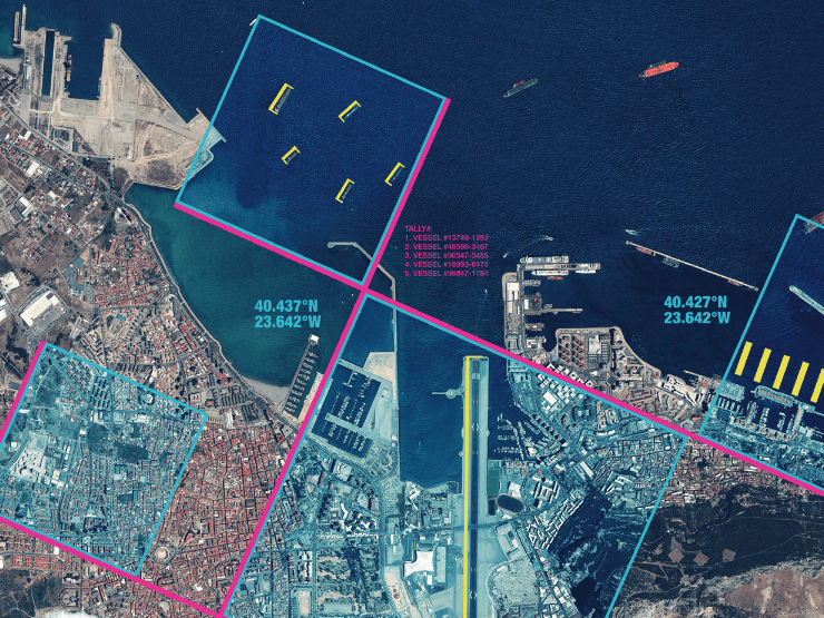
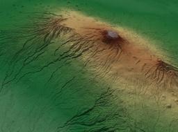
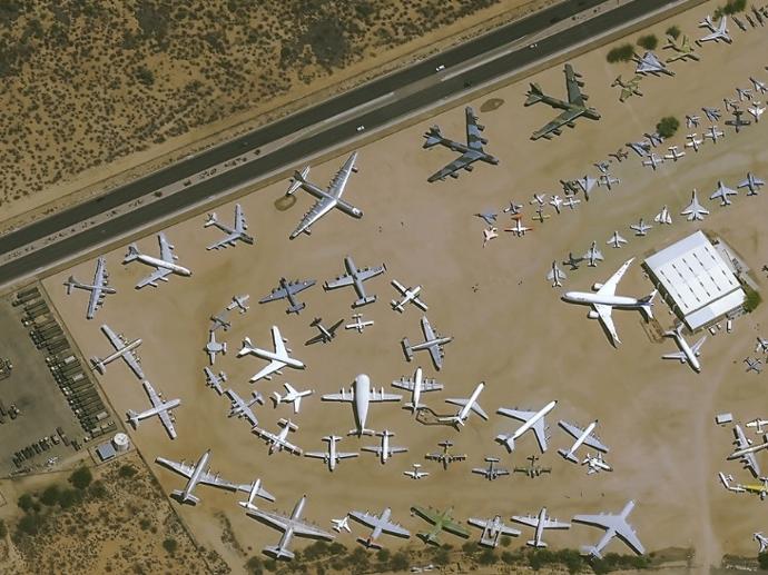
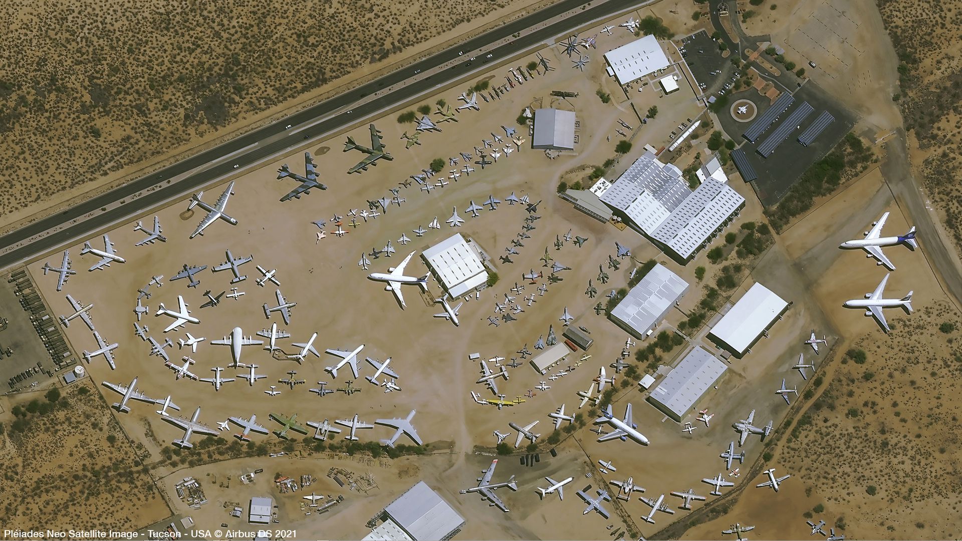
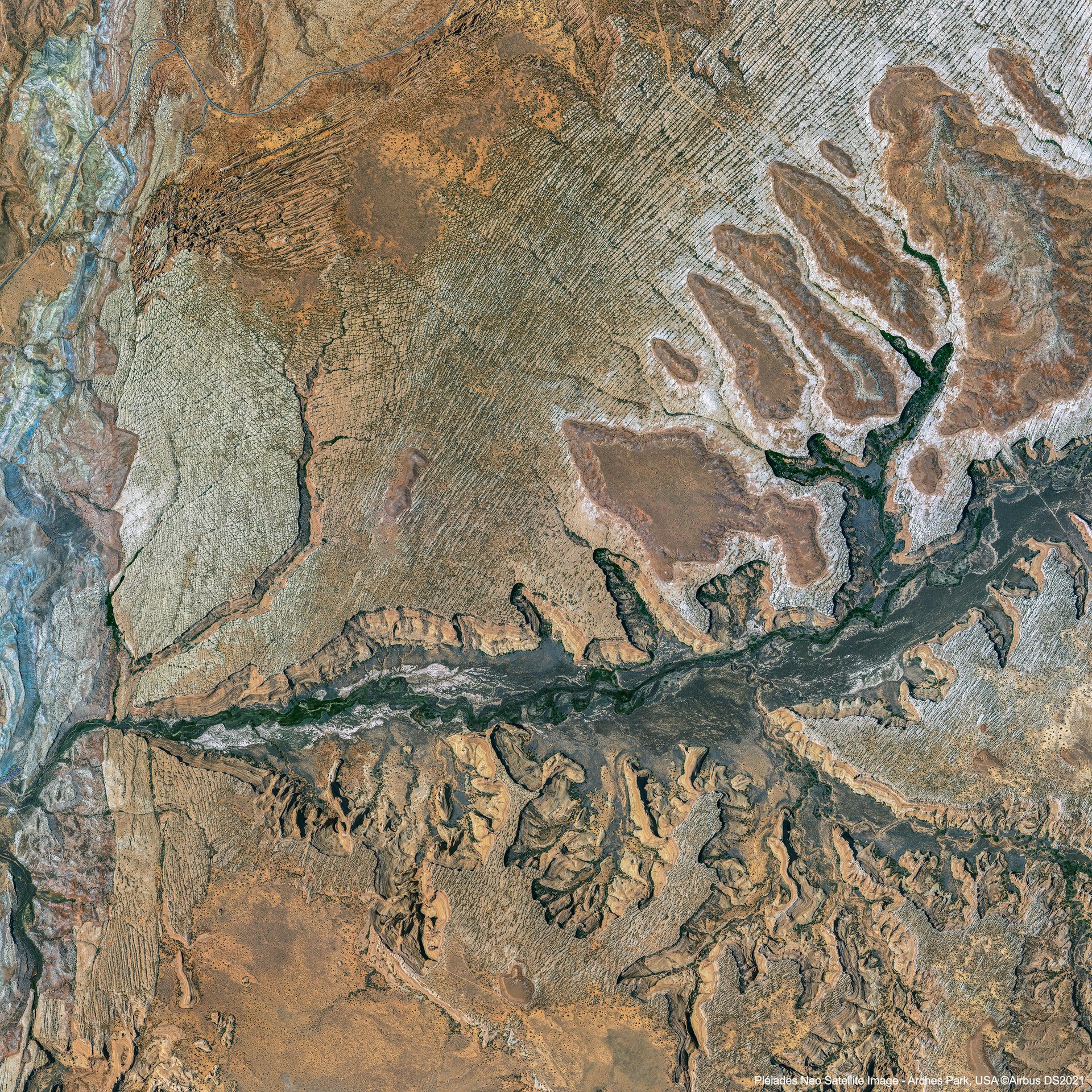
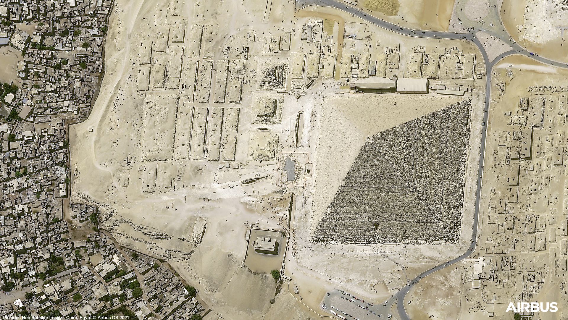
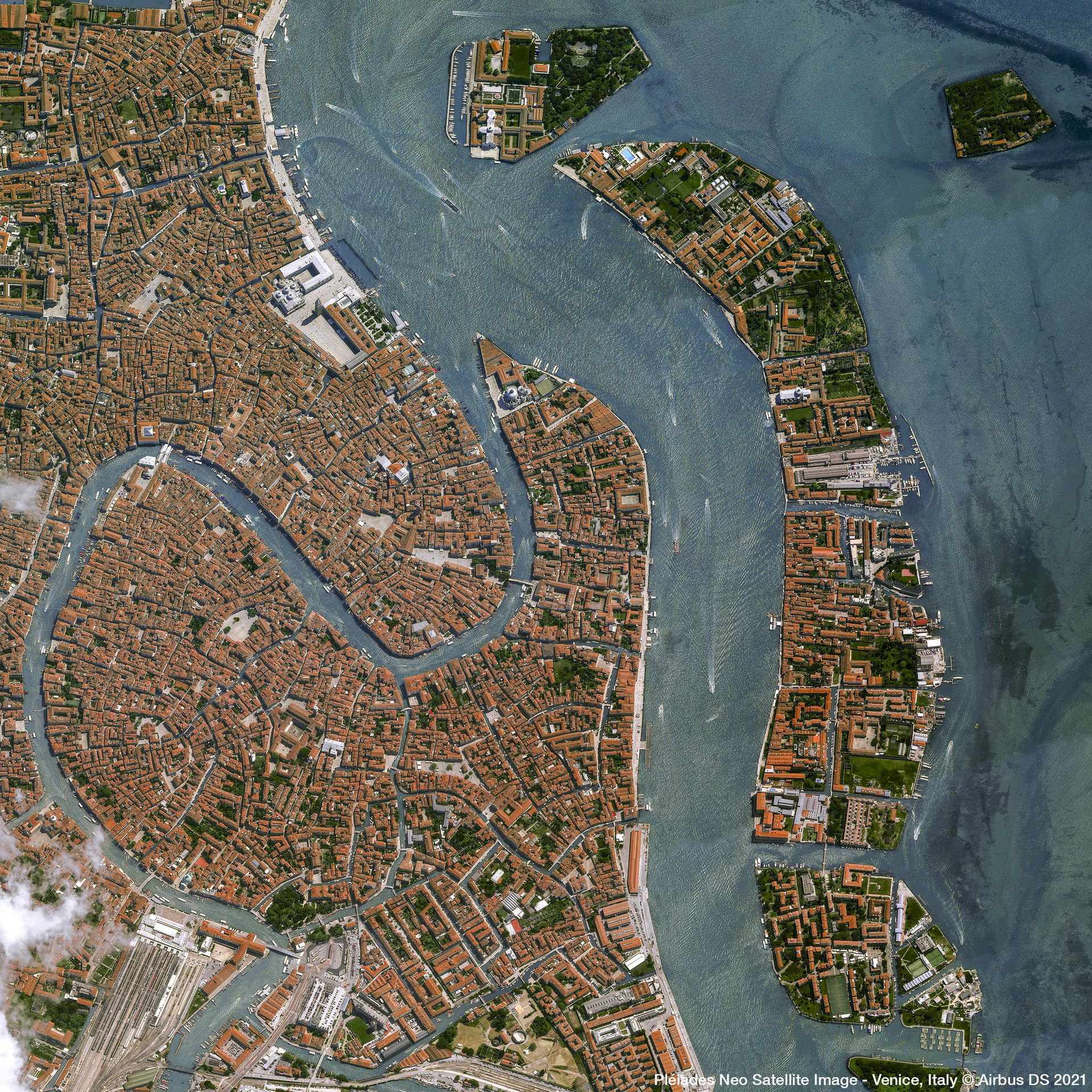
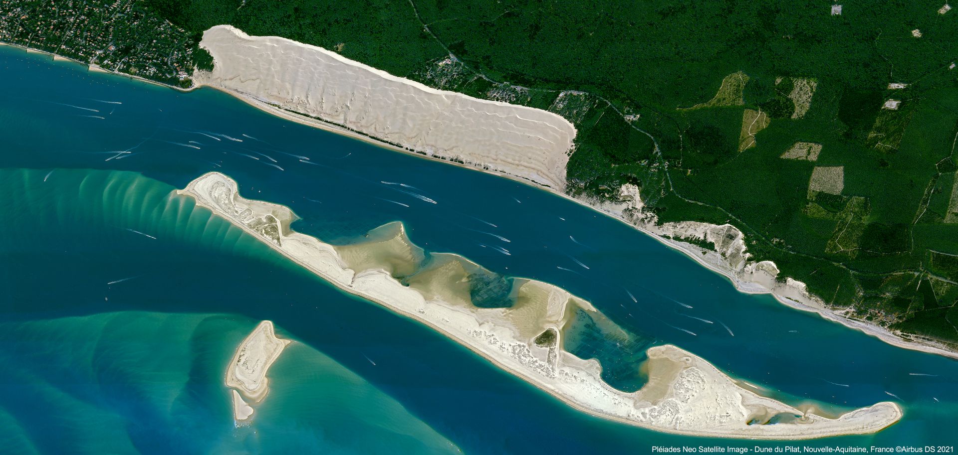
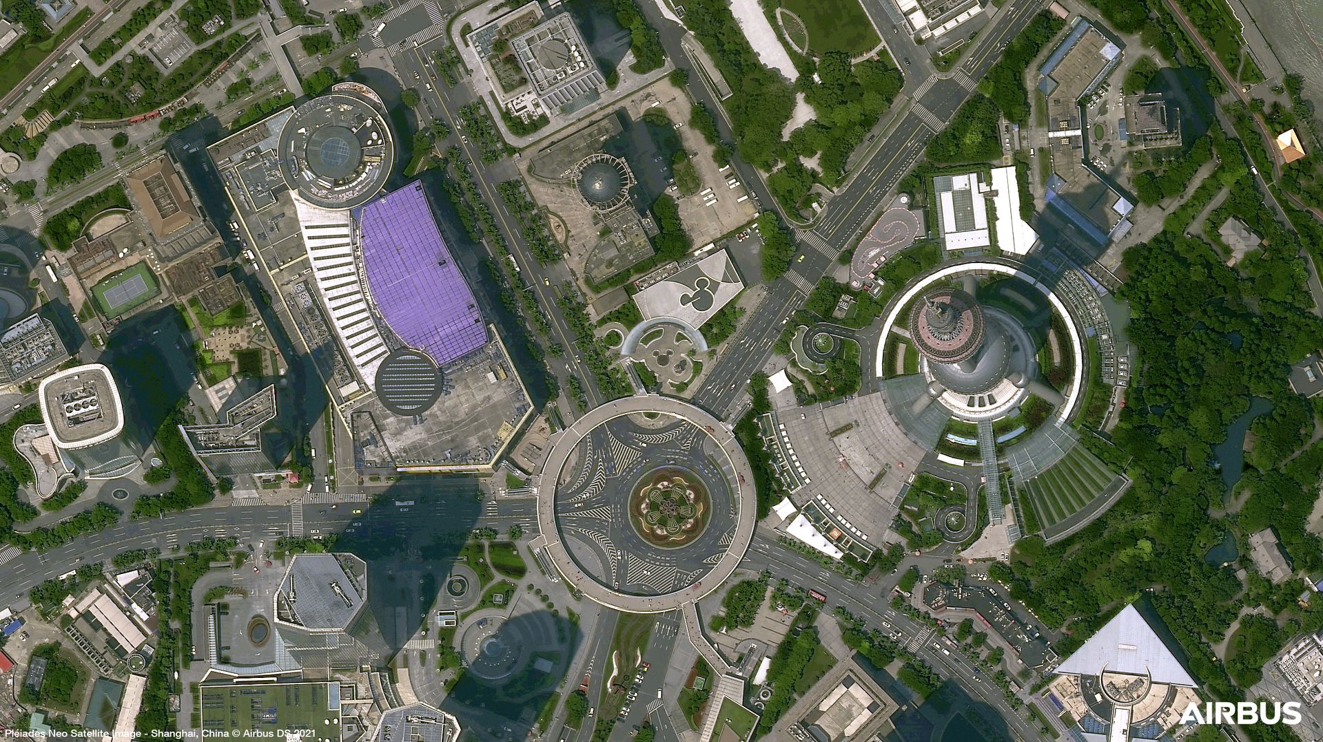
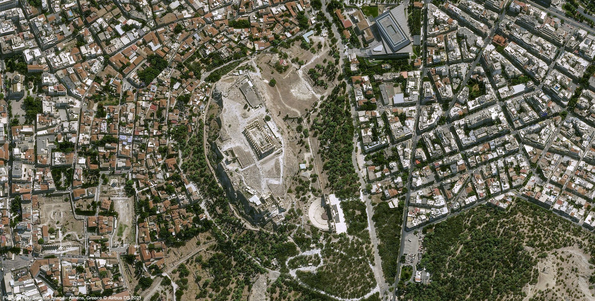
Gallery
Key features
Detailed and precise image products at 30 cm spatial resolution.
Daily revisit capacity (30° off-Nadir), and twice daily at 46° off-Nadir areas.
Enables generation of analytics for automatic detection and object identification.
Highest commercial resolution combined with the most accurate geolocation.
Mono, stereo, and tri-stereo acquisitions.
Improved weather forecast for better acquisition success rate.
Key applications
Crisis management
Border monitoring
Counter-terrorism
Air and land navigation support
Border monitoring
Counter-terrorism
Air and land navigation support

Infrastructure
Calculation of container numbers
Monitoring of construction sites
Natural hazard risk analysis and damage assessment
Calculation of container numbers
Monitoring of construction sites
Natural hazard risk analysis and damage assessment

Energy
Monitoring of tankers fill rates
Determination of best locations for new green roof and solar panel implementation
Determination of the most favorable wind farms' locations
Monitoring of tankers fill rates
Determination of best locations for new green roof and solar panel implementation
Determination of the most favorable wind farms' locations
FAQs
Some restrictions do apply when ordering Pléiades Neo data. These are related to the minimum area and minimum order and the following:
- For Archived data, the minimum area of interest is 25km², with at least 500m in one direction.
- Minimum order is €450 for solo imagery, €850 for stereo, and 1100€ for tristereo.
For Tasking data, the minimum area of interest is 100km², with at least 5km in one direction.
In case more than one AOI is required, please contact us for a custom order tailored to your needs.
The EULA of Pléiades Neo is under the authority of Airbus Space & Defence and can be found here.