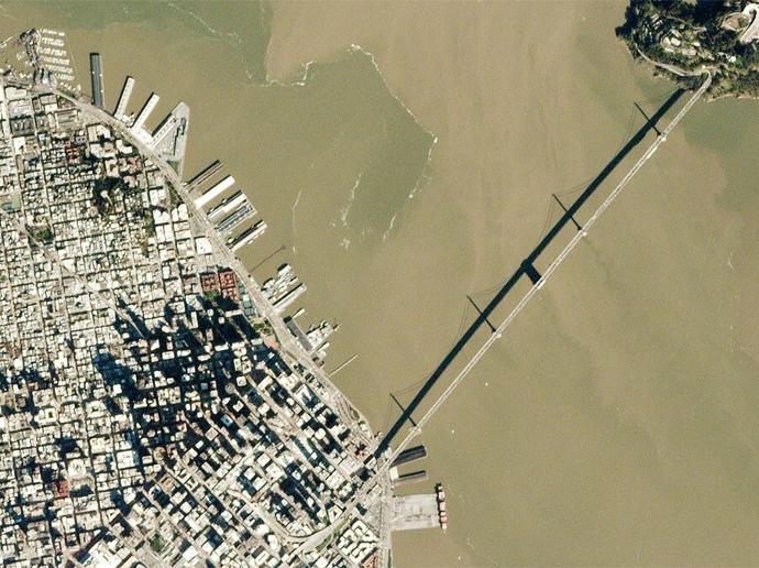
PlanetScope Monitoring
Stay ahead in today’s rapidly evolving business landscape with a persistent view of business operations and assets – everywhere on Earth. But traditional imagery solutions create information gaps and risks in the decision-making process. PlanetScope Monitoring leverages the largest satellite constellation in history to empower customers with real-time insights about places they care about, so they can be proactive and confident in every decision.
PlanetScope Monitoring provides access to 3.7-meter resolution images of the entire Earth daily. Available through a subscription model, Planet Monitoring can be scaled to the requirements of your analysis and application needs. Perfect for time-sensitive applications, such as crop health management, asset tracking, disaster management, or mapping and GIS.
With a PlanetScope Monitoring subscription, customers can access the Planet Explorer app from Planet and see the latest images over their area of interest. Options include not only future imagery but also archive access as well. Customers may optionally choose to download the data for further analysis. Furthermore, you can easily integrate other Planet products, i.e. Planet Monitoring Analytic Feeds for vessel monitoring or aircraft detection.
Please note that the minimum order is €4,500.00 for this product.
Key features
Quick access to very high-resolution imagery at 3.7m
Extensive archive imagery dating from 2009
Over 300 million square kilometers of imagery
Four multispectral bands: RGB and Near Infrared
Daily basis update
Ready-to-use images and data integrated simply into your existing workflow
Key applications

Agriculture
Continuous field coverage
Gain agronomic insight through field-level detail
Monitor and analyze field and crop health from preseason to harvest
Continuous field coverage
Gain agronomic insight through field-level detail
Monitor and analyze field and crop health from preseason to harvest

Infrastructure
Monitor assets in their entirety, remotely
Evaluate competitor activity, production methods, and equipment
Manage and preempt risks
Monitor assets in their entirety, remotely
Evaluate competitor activity, production methods, and equipment
Manage and preempt risks
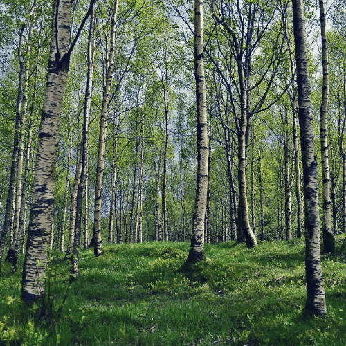
Forestry
Optimize timber harvest operations
Monitor and manage forest health
Prevent illegal and unpermitted clearing of forest
Optimize timber harvest operations
Monitor and manage forest health
Prevent illegal and unpermitted clearing of forest
FAQs
Scalable subscription offerings are available. Please fill out the form below with your requirements in terms of timeliness and area coverage and we will contact you with the one that fits best to your needs.
Yes, it is! However, please note that download access is available only for Monitoring data - data acquired after the contract signing date. For the download of Archived images (images captured before the start of your PlanetScope Monitoring subscription), please see the PlanetScope Archive product.
The PlanetScope Constellation comprises Dove CubeSats continuously imaging the Earth with a 3.7-meter resolution in RGB and NIR bands.
There is no minimum AOI for PlanetScope Monitoring data.
The minimum order for PlanetScope Monitoring is €4,500.
When your order is ready, we will provide you via email the credentials for accessing your purchased imagery.
The official PlanetScope product guide by Planet Labs can be found here.
In case more than one AOI is required, please contact us for a custom order tailored to your needs.
The EULA of PlanetScope Monitoring is under the authority of Planet Labs and can be found here.