Planet Monitoring Analytic Feeds
With 140+ satellites in orbit, Planet images the entirety of Earth’s landmass every day, providing an unprecedented dataset for deep learning. Planet Analytic Feeds enables you to spend less time building models and image processing pipelines, and more time on the analysis that drives better decision-making. With this pre-bundled set, you get a PlanetScope Monitoring subscription for your area of interest, as well as the daily analytics you need to take action.
With Planet Monitoring Analytic Feeds you can select among the following feeds:
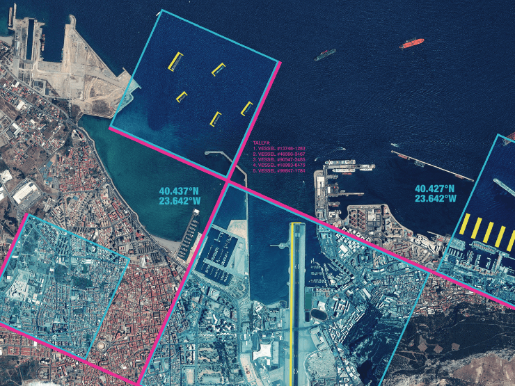
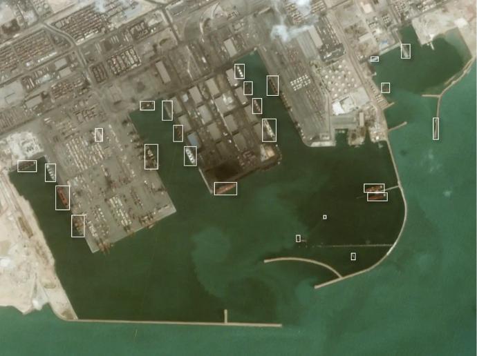
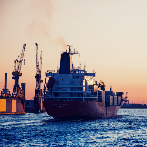
Vessel detection: Enhance maritime datasets with daily vessel detection in ports and coastal areas. Observe patterns of life, detect illegal activities, and quantify economic activity.
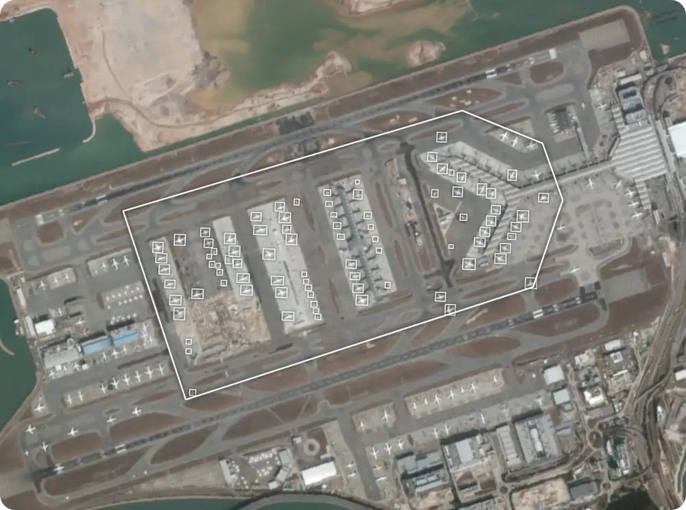
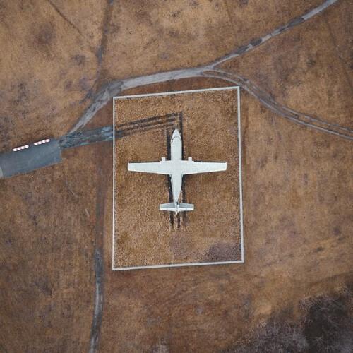
Plane detection: Observe the arrival and departure of aircraft on a daily basis. Monitor patterns of life, detect unusual behavior and quantify the movement of planes.
And some further technical information:
Vessel detection | Plane detection | |
Statistical output | Count of vessels | Count of aircraft |
Analytic output | GeoJSON feature collection | GeoJSON feature collection |
| Imagery | PlanetScope imagery | PlanetScope imagery |
| Model | Object Detection | Object Detection |
| Refresh | Daily | Daily |
| Coverage | Global ports
and coastlines | Airports
and airfields
globally |
Key features
Get the earliest signal of vessels and aircraft over your area of interest
Fill in data gaps
Understand trends and anticipate changes
Leverage historical data to understand baselines
Monitor patterns of life & anomalies
Broad-scale coverage & frequent updates
Key applications
Aviation
Observe departure and arrival of aircraft
Quantify the number of aircrafts over time
Monitor uptick and downturns of economic activity
Observe departure and arrival of aircraft
Quantify the number of aircrafts over time
Monitor uptick and downturns of economic activity
Maritime
Fill in data gaps & complement AIS or ground surveys
Monitor patterns of life & anomalies
Identify vessels that have gone dark
Fill in data gaps & complement AIS or ground surveys
Monitor patterns of life & anomalies
Identify vessels that have gone dark
FAQs
With the standard bundle, you get one Feed of your choice, i.e. Vessel Detection or Plane Detection, along with the source imagery, in this case, PlanetScope Scenes.
Both the Scenes and the Feed outputs can be streamed or downloaded.
Planet runs an object localization model to create bounding boxes surrounding vessels in ports or planes worldwide. Using Planet's daily cadence, you can be provided with vessel or plane locations, be informed on the pattern of life analyses, and draw attention to where it's needed.
The minimum order for Planet Monitoring Analytic Feeds is 100 sq.km.
In case more than one AOI is required, please contact us for a custom order tailored to your needs.
The EULA of Planet Monitoring Analytic Feeds is under the authority of Planet Labs and can be found here.