Planet Basemap Analytic Feeds
Planet Basemap Analytic Feeds leverage machine learning and computer vision techniques to extract critical objects and features from Planet imagery, providing customers with deeper insights at a higher frequency. Planet Basemap Analytic Feeds can be applied to Planet imagery across the entire globe, from a continent of interest, to national, or city-wide level. Global scale means you can get features and object detections off-the-shelf, no custom builds required.

Many companies that leverage satellite imagery are overwhelmed by the volume of data, which delays relevant insights. Meanwhile, most of the imagery is outdated by the time it’s received, provides an incomplete dataset, and can’t power timely, data-driven decisions.
Planet Basemap Analytic Feeds leverage machine learning and computer vision techniques to extract critical objects and features from Planet imagery, providing customers with deeper insights at a higher frequency. Available for geospatial analysis in GeoJSON and GeoTIFF format as well as time series analysis as a summary csv.
You can select among the following Analytic Feeds:
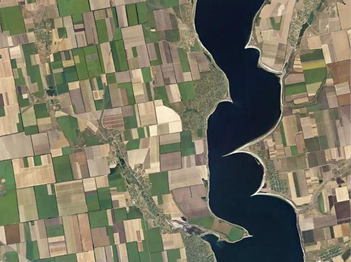
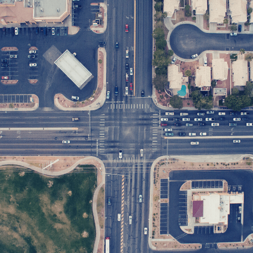
Road detection: Upgrade your workflows with monthly road layers at scale, empowering you to update maps, track road development, and improve routing of resources.
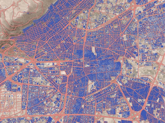
Building detection: Get monthly building detections at scale, empowering you to update maps, track construction, and monitor land use and enforce permitting.
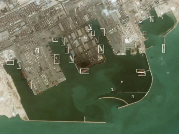
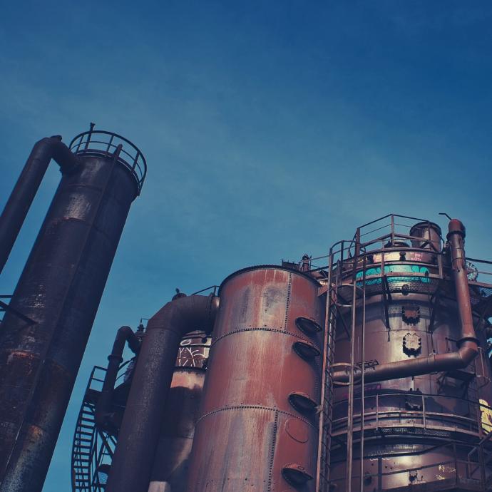
Well pad detection: Monitor oil and gas development across basins with monthly or weekly well pad detections. Track construction, get land acquisition insights, and streamline operations.
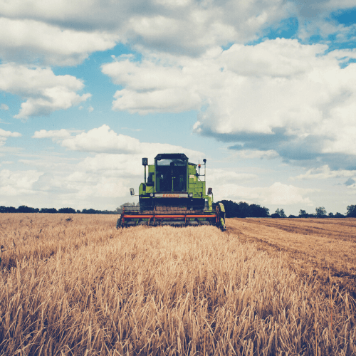
Silo bag detection: Get reliable signal of grain production via monthly silo bag detections. Understand supply, mitigate risk, and predict when shortages and gluts may occur.
And some further technical information:
Road Detection | Building Detection | Well pad Detection | Silo bag Detection | |
Statistical output | Area of roads (sq meters) | Area of buildings (sq meters) | Count of Well Pads | Count of Silo Bags |
Analytic output | Raster GEOTIFF | Raster GEOTIFF | Raster GEOTIFF | Raster GEOTIFF |
Imagery | Planet Basemap | Planet Basemap | PlanetScope | Planet Basemap |
Model | Semantic segmentation | Semantic segmentation | Object Detection | Object Detection |
Refresh | Monthly | Monthly | Monthly or weekly | Monthly or bimonthly |
| Coverage | Global | Global | Permian Basin | Argentina |
Key features
Get the earliest signal of new Roads, Buildings, Well Pads, and Silo Bags
Understand trends and anticipate changes
Broad-scale coverage & frequent updates
Leverage historical data to understand baselines
Detect anomalies early
Save time and cost with automated change detection
Key applications
Infrastructure
Monitor infrastructure and construction
Track urban growth & plan future development
Get competitive intelligence in remote locations
Monitor infrastructure and construction
Track urban growth & plan future development
Get competitive intelligence in remote locations
Agriculture
Monthly grain production monitoring
Early awareness of shortages and gluts
Risk mitigation and supply understanding
Monthly grain production monitoring
Early awareness of shortages and gluts
Risk mitigation and supply understanding
Oil & Gas
Construction monitoring across basins
Routing of resources and streamlining operations
Early competitive intelligence and land acquisition insights
Construction monitoring across basins
Routing of resources and streamlining operations
Early competitive intelligence and land acquisition insights
FAQs
With the standard bundle, you get one Feed of your choice, i.e. Roads, Buildings, Well pads, or Silobags, along with the source imagery, in this case, Basemaps. Both the Basemaps and the Feed outputs can be streamed or downloaded.
Planet runs an image segmentation model to extract pixels that are roads/ buildings vs. pixels that are not roads/ buildings. Using Planet's monthly cloud-free mosaics, you can receive an up-to-date depiction of road/building locations within your requested AOI.
Planet runs an object localization model to create bounding boxes around well pads or silo bags. Using Planet's monthly cloud-free mosaics, you can receive an up-to-date depiction of well pads/silo bag locations within your requested AOI.
The minimum order for Planet Basemap Analytic Feeds is 100 sq.km.
In case more than one AOI is required, please contact us for a custom order tailored to your needs.
The EULA of Planet Basemap Analytic Feeds is under the authority of Planet Labs and can be found here.