OneAtlas Analytics
Airbus has built accurate and powerful geospatial analytic services that leverage expertise across the industry enabling users to get the information and insights they need when they need it.
OneAtlas Analytics includes access to the following:
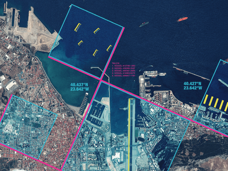
Activity Analysis and Monitoring: Monitor areas of interest to gain clarity on supply chains and commodities: car and trucks counting, ship vessels identification at sea, aircraft identification and classification.
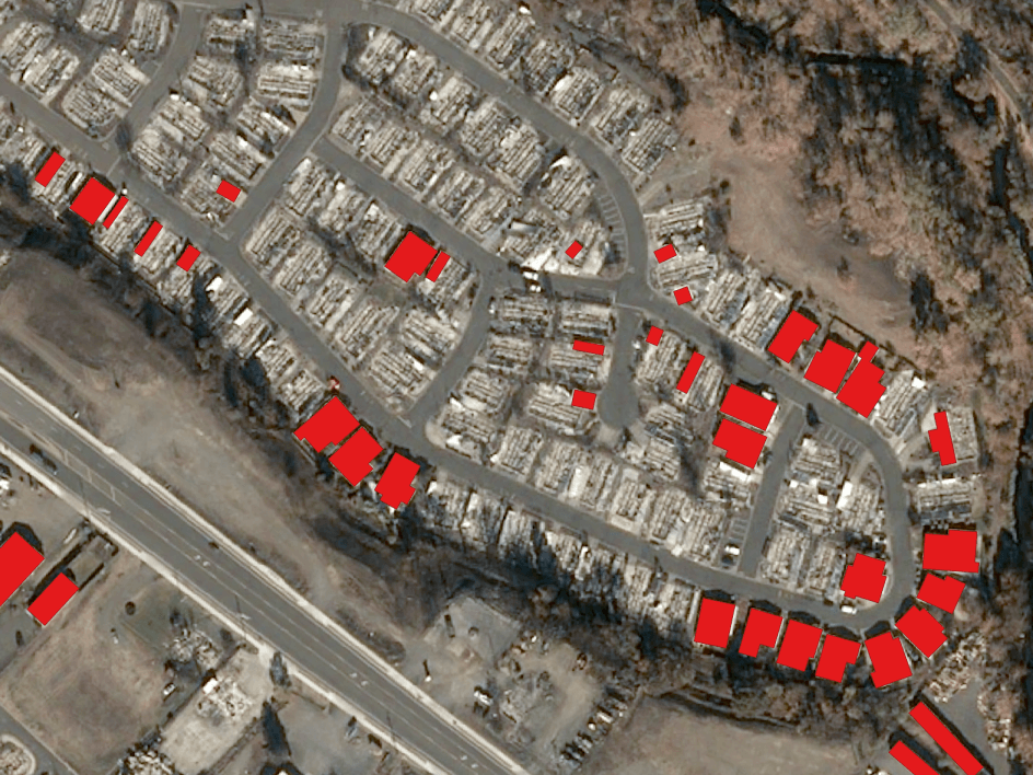
Land Use & Change Detection: Understand what’s happening on the ground and monitor man-made changes over your areas of interest.
Land Use and map extraction is also available with 12+ classes: buildings, roads, parking lots, pavements, driveways, swimming pools, sports fields, railway, water, grassland, forest and bare land.
Choose between immediate analysis or monitoring over time with results delivered in ready-to-use formats.
Key features
Get geospatial insights easily and
automatically.
Activity level measurement through vehicle counting (i.e. cars, trucks, military & commercial planes).
Land monitoring focused on infrastructure or land use changes.
Choose between immediate analysis (fully automatic or semi-automatic) or monitoring over time.
Results delivered in ready-to-use-formats, compatible with leading GIS platforms.
Integrate analytics in your own application using our dedicated APIs.
Key applications

Infrastructure
Car and truck counting
Aircraft identification & classification
Change detection on buildings and roads
Car and truck counting
Aircraft identification & classification
Change detection on buildings and roads

Maritime
Detecting ships and vessels
Mapping of land cover on the coastline
Mapping of fishing zones
Detecting ships and vessels
Mapping of land cover on the coastline
Mapping of fishing zones
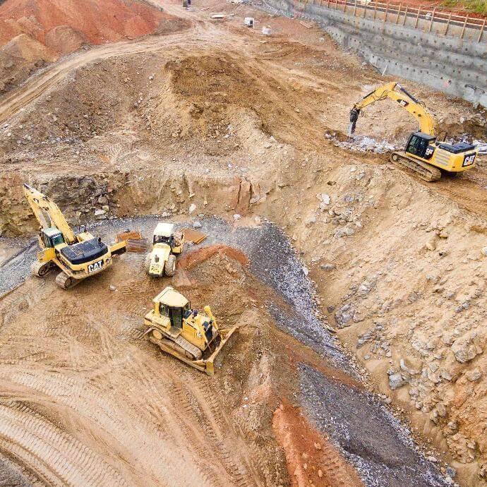
Construction
Progress monitoring in construction sites
Vehicle identification in sites
Mapping of land cover for site selection
Progress monitoring in construction sites
Vehicle identification in sites
FAQs
This analytics detects cars and small utility vehicles.
Source imagery: Pléiades
Process type: fully automatic
Classification: None
This analytics detects commercial trucks, trailer trucks and buses.
Source imagery: Pléiades
Process type: fully automatic
Classification: None
This analytics detects ships at sea. It is not suited for ships parked close to each other in a harbor or marina. The size of detected ships is down to 20 meters (ships between 10 meters and 20 meters can also be detected but with a lower precision.
Source imagery: Pléiades or SPOT 6/7
Process type: fully automatic
Classification: None
This analytics detects carrier aircraft, helicopters, fighter aircraft and small aircraft. Currently it is in a beta version.
Source imagery: Pléiades
Process type: fully automatic
Classification: 4 classes are available
This analytics is trained to :
- detect “infrastructures changes”
- ignore mobile objects (vehicles, ships, etc) as well as natural or seasonal vegetation change. In this fully automatic mode, the algorithm may include a significant fraction of “false positives”
Source imagery: Pléiades or SPOT 6/7
Process type: fully automatic
Classification: None
All analytics distributed on OneAtlas have been subject to extensive qualification testing. This qualification process is based on the comparison of each algorithm results to independent ground truth data and is applied on a large, diverse and worlwide distributed set of test cases to ensure full representativity.
All analytics distributed have reached high levels of recall and precision through this qualification process. These levels are in line with the best state of the art accuracy levels for such automated algorithms.
You can contact us for a custom package of OneAtlas Analytics! Please fill out the form below and tell us about your exact requirements. We will come back to you as soon as possible.
There’s no limit in the AOI size, but there is a minimum charging price of 5km² per AOI.
When reaching the end date of your subscription, you will receive a notification in your email that you have provided to us. After the end of your subscription, your access will be blocked, but you can still use the data that you have downloaded.
They are both OGC standard formats. They allow an easy use of streaming services in GIS tools or libraries. WMTS is recommended by the provider since it is faster: it provides a pyramid of tiles reducing waiting time for the data and bandwidth.
Yes, the service is available 24/7.
Airbus Defence & Space Terms & Conditions apply.