KOMPSAT-5
KOMPSAT-5 SAR payload includes X-band (9.66 GHz) Synthetic Aperture Radar with a fixed antenna capable of electronic steering both in the azimuth and the elevation planes. It provides high-quality SAR satellite imagery in multiple acquisition modes, including extra-wide swath with 20-meter resolution and 100 km width, ultra-high mode with up to 0.85-meter resolution and 5 km width, and standard mode with a resolution of 2.5-meters and a swath of 30 km. For all observation modes, HH, VV, HV, or VH polarization is available for ordering.
Three Synthetic Aperture Radar (SAR) imagery is widely used where reliable images need to be taken independently of cloud cover and daylight. SAR images are perfect for tasks such as topography (Digital Elevation Model generation with interferometry), change detection and surveillance, agriculture monitoring, crop classification, soil moisture, geology, disaster monitoring, and maritime applications like oil spill monitoring and ship detection.
KOMPSAT (Korean Multi-Purpose Satellite) program is a part of the Korean government’s space development program, which aims at providing very high-resolution satellite imagery to national and international remote sensing society.
Some general information about KOMPSAT-5:
Launch date | August 22, 2013 |
Altitude | 550 km |
Orbit repeat cycle | 28-day dawn-dusk orbit |
| Location accuracy | 4.82 m RMSE 7.32 m CE90 |
| Inclination | 97.06 deg. |
| Polarization | Single polarization (VV, HH, VH, HV) |
| File format | HDF5 / GeoTIFF |
| Map projection / Datum | UTM / WGS 84 |
And some ancillary information that will help you in the ordering process:
Imaging Mode | Ground Sampling Distance(at 45° nominal incidence angle) | Swath (at 45° nominal incidence angle) |
Spotlight High Resolution (HR) | 1 m | 5 km |
Stripmode Standard (ST) | 3 m | 30 km |
ScanSAR Wide Swath (WS) | 20 m | 100 km |
The nominal and extended access regions for all imaging modes are respectively 20° ~ 45° and 45° ~ 55°.
The standard processing of the KOMPSAT-5 SAR data is as much as possible aligned with the definition deriving from literature. If some alternative approach has been adopted for the product specification, it is oriented to add value to the output data, preserving, in any case, the possibility for the final user to remove the effects of the additional non-standard processing applied to the data. The following table shows the three different processing levels that are available for ordering:
Processing level | Info and Projection |
L1A | - Single Look Complex, In-Phase and Quadrature focused
data, weighted and
radiometrically equalized vs.
slant range losses - Slant range / Azimuth (Zero-Doppler) |
L1C | - Geocoded Earth Ellipsoid, Amplitude of the focused data,
multilooked - UTM/GEOG, EGM96 EQPOT Surface |
L1D | - Geocoded Earth Terrain, Backscattering coefficient of the
observed scene, multilooked (but
for High-Resolution Mode), with
annexed the Incidence Angles
Mask - UTM/GEOG, DEM + EGM96 EQPOT Surface |
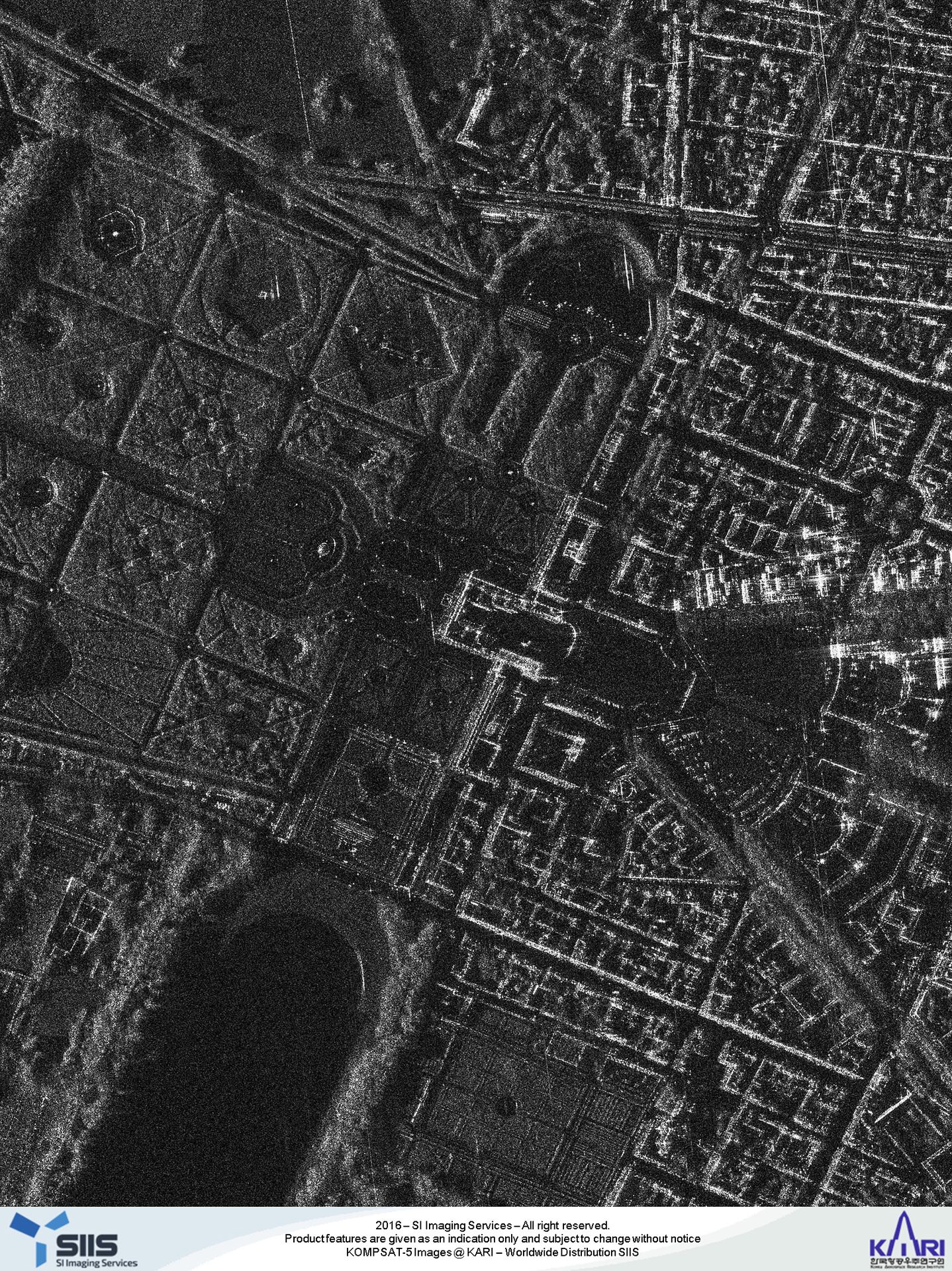
Gallery
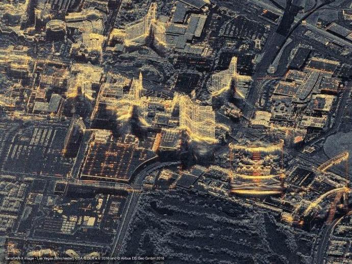
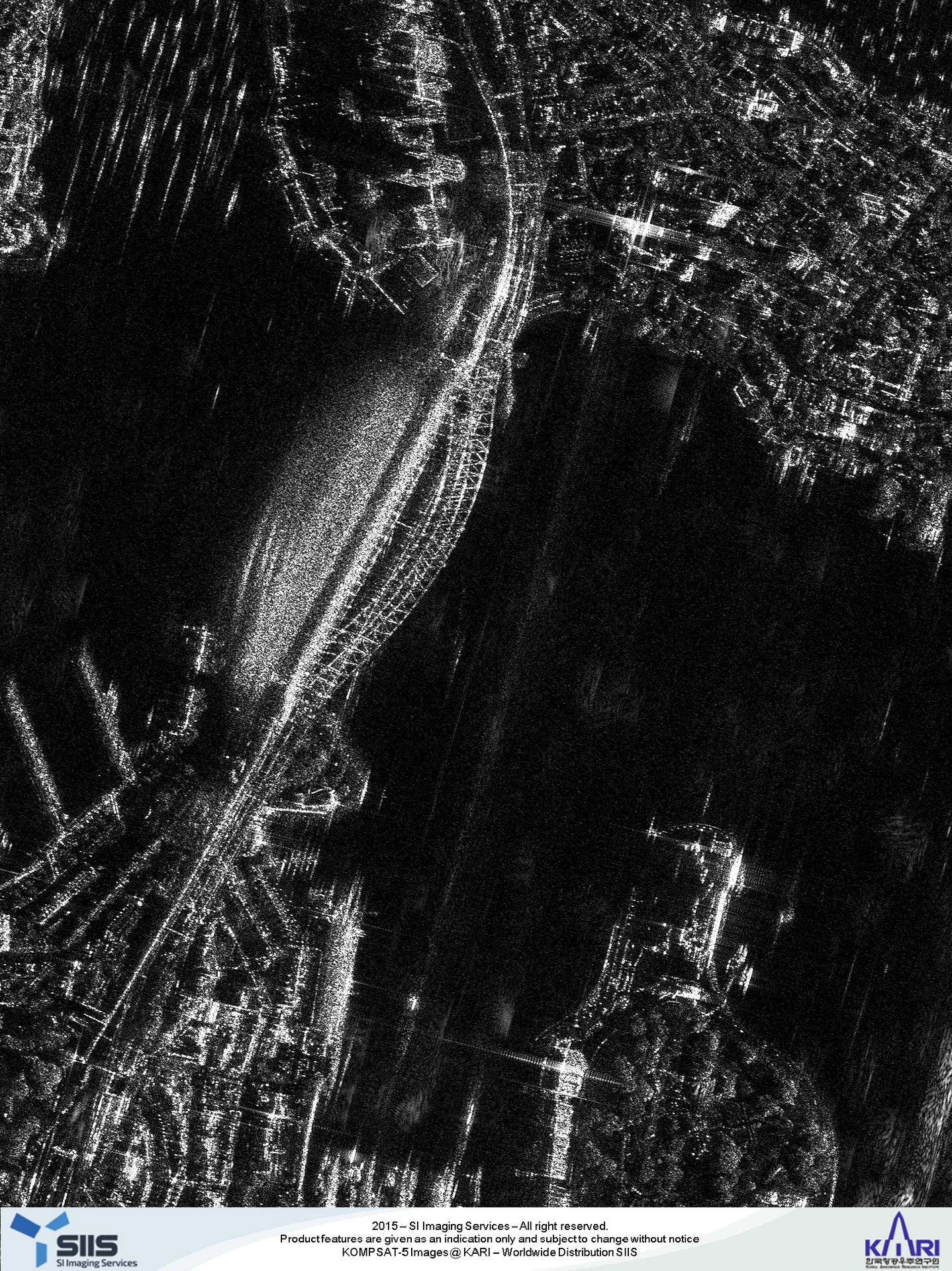
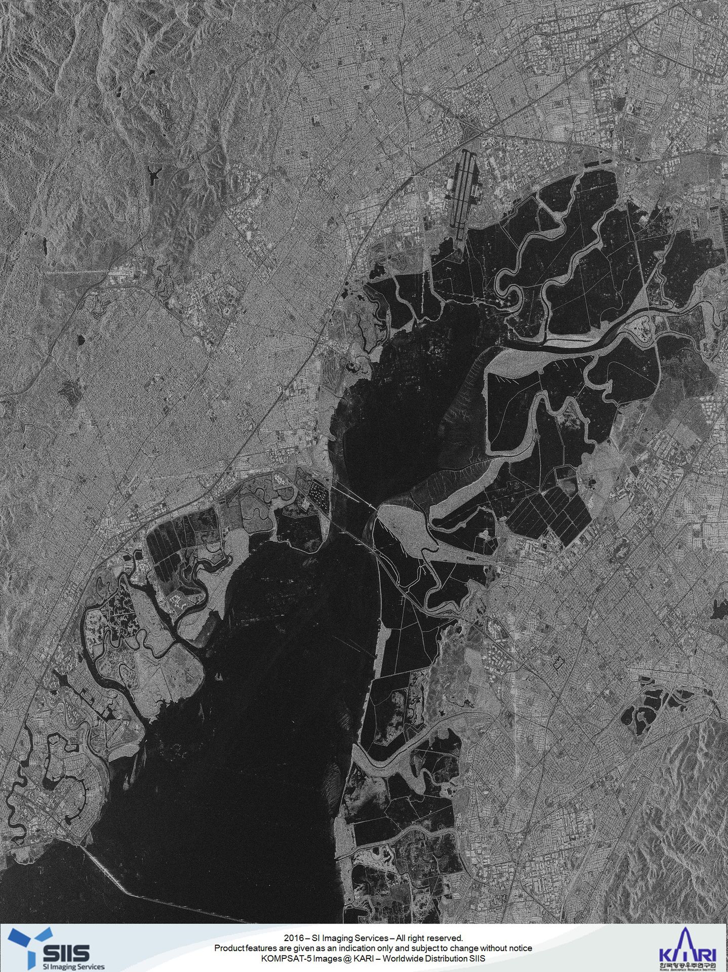
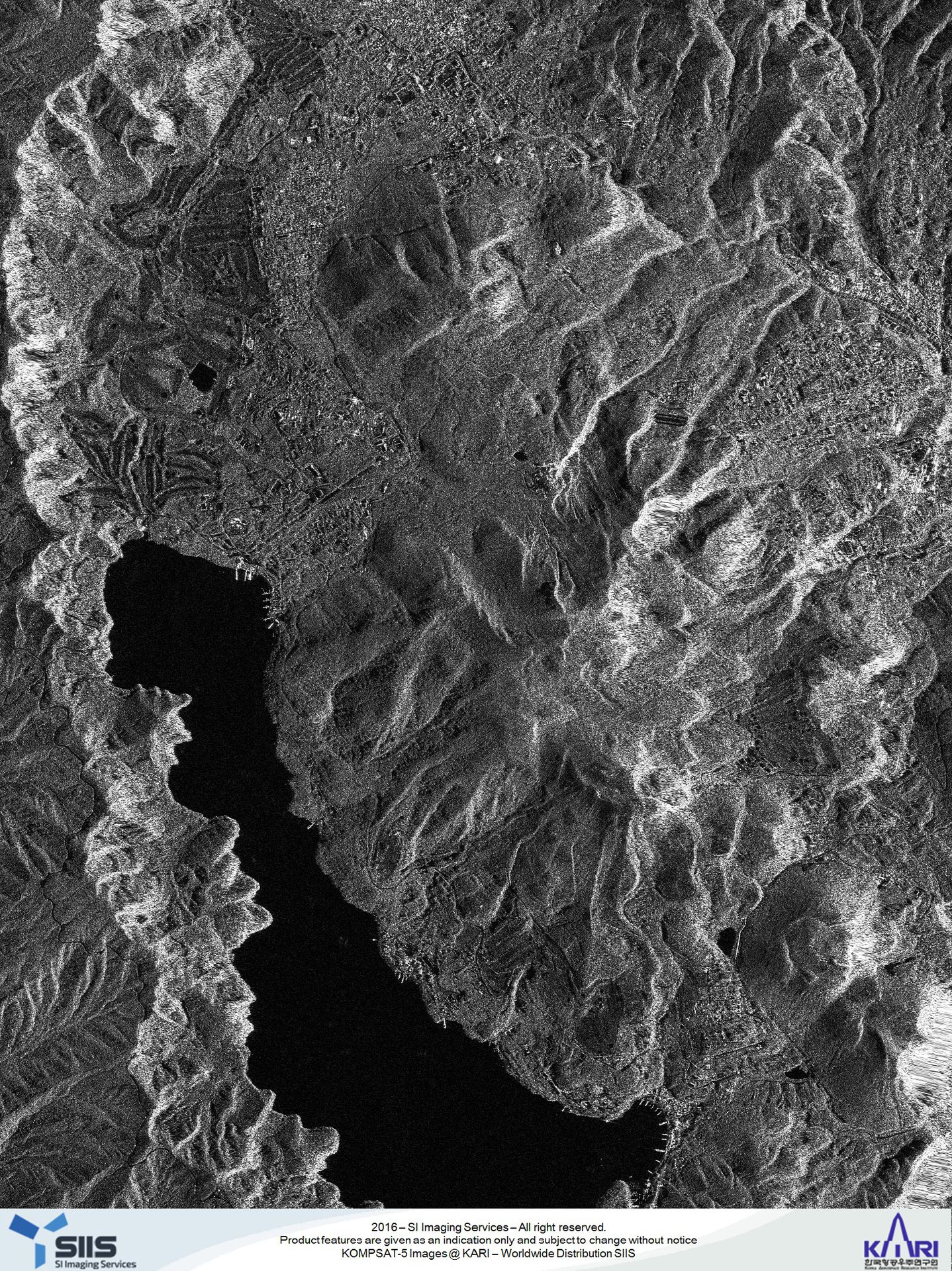
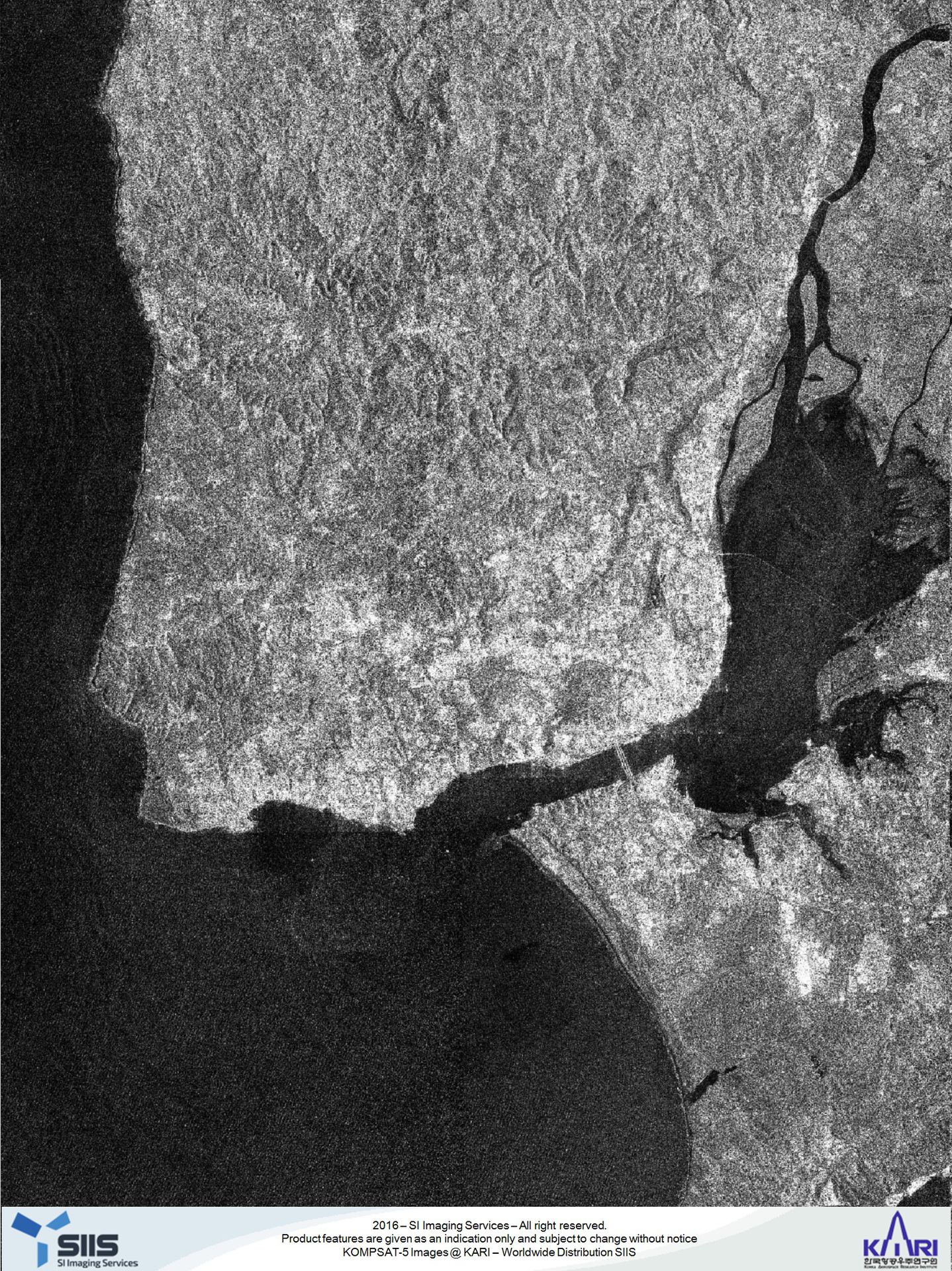
Imaging mode: High Resolution (HR)
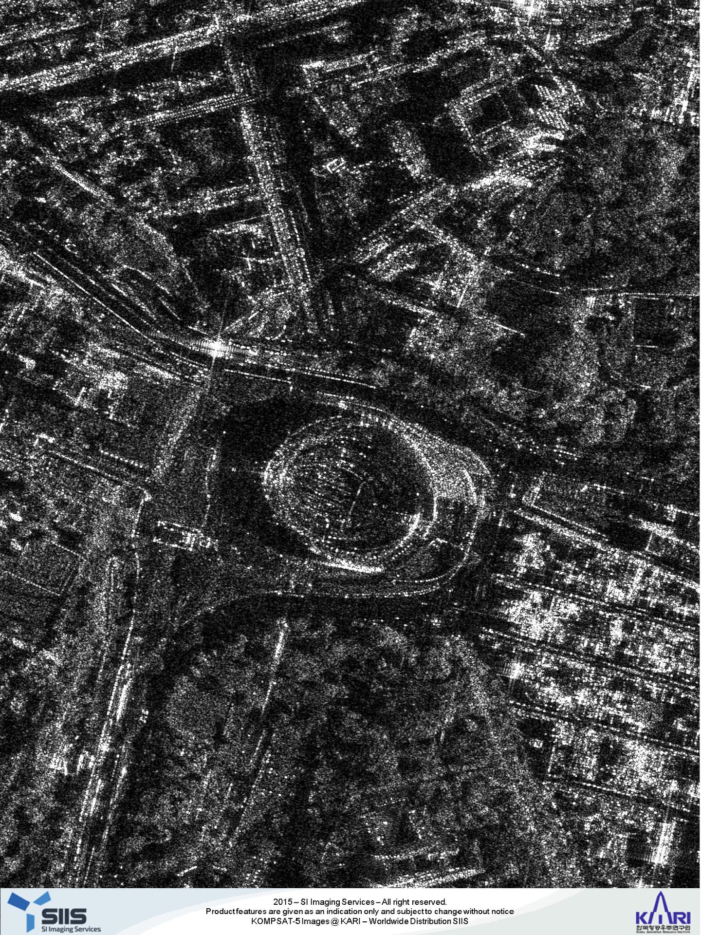
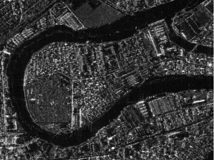
Imaging mode: Standard (ST)
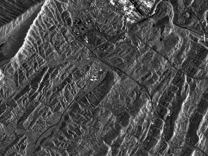
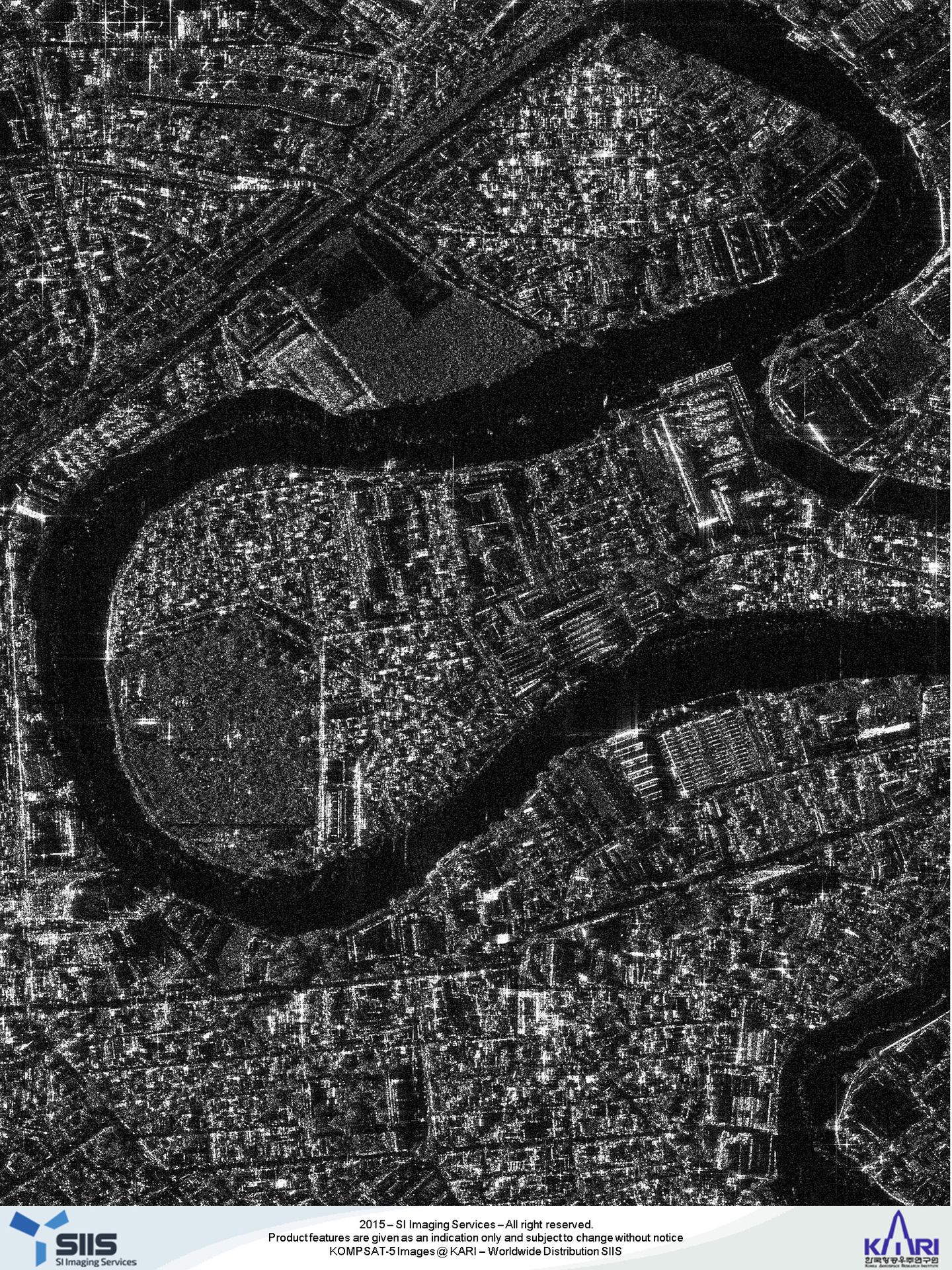
Imaging mode: Wide Swath (WS)
Key features
Very high-resolution SAR X-band imagery of up to 1m.
Data coverage since 2014.
Weather and daylight independent.
Three different processing levels to choose from, depending on your application.
Excellent geometric accuracy and radiometric accuracy.
Access to any point on Earth.
Key applications

Maritime
Counting ships and vessels
Mapping oil spills and position forecasting
Mapping of fishing zones
Counting ships and vessels
Mapping oil spills and position forecasting
Mapping of fishing zones

Infrastructure
Monitoring illegal construction
Analyzing roads' condition
Change detection and surveillance
Monitoring illegal construction
Analyzing roads' condition
Change detection and surveillance
Environment
Assessing slope failure and soil erosion
Flood analysis and damage assessment
Elevation model generation with interferometry
Assessing slope failure and soil erosion
Flood analysis and damage assessment
Elevation model generation with interferometry
FAQs
With Archive, you get past KOMPSAT-5 imagery over the desired area of interest. The image catalogue starts from 2013. So, when you send us a quote request for KOMPSAT-5 Archive, our team searches the existing catalogue for you according to the AOI and date of your choice and reaches you with all the available options.
With Tasking, you can have new KOMPSAT-5 acquisitions over your desired AOI; you just have to include additionally in your quote request the desired polarization, orbit direction, as well as the collection time frame.
New tasking priority provides two options designed to meet a variety of your needs. These options consider that balance the cost against the need for timeliness, level of risk, and control over the collection window.
Moreover:
with standard priority, the order shall be confirmed before 03:00 UTC two working days before the start of the collection window
with higher priority, the order shall be confirmed before 03:00 UTC one working day before the start of the collection window
Beyond the standard options, individual product configurations are possible:
Different data acquisition modes, including stereo imagery to derive 3D models
Repetitive acquisitions for monitoring purposes
Multi-user licenses for larger enterprises
For universities, an academic discount is available. Please provide a short description of your project if you wish to apply for this discount
Please fill out the form below adding in the 'Remarks' section your exact requirements - we will get back to you asap. Volume discounts for larger areas are also available
The official KOMPSAT-5 Product Guide by SI Imaging Services can be found here.
The EULA of KOMPSAT-5 is under the authority of Korea Aerospace Research Institute and SI Imaging Services and can be found here (page 53 onwards).