Hexagon Pixel Delivery
Hexagon Pixel Delivery provides imagery or elevation data for local use over your area of interest. Hexagon data sets are some of the most high-resolution data on the market for reference orthophotos and digital surface models (DSMs).
These datasets are perfect for long-term projects and projects requiring local data for analysis. Because the data is stitched together in a mosaic, the result is a seamless dataset ready for analysis.
Keep your high resolution data locally with Hexagon Pixel Delivery! Simply select your area of interest, the dataset you need, and get your data delivered fast. This is ideal for users who wish to utilize the data long-term and have local infrastructure necessary for analyzing their data.
Currently, Hexagon Pixel Delivery data are available for AOIs within the United States of America, Hawaii and Puerto Rico and the European Union. To check if your area of interest is included in the abovementioned regions, please fill out the quote form below including a shapefile with the exact AOI boundaries.
Products available through Hexagon Pixel Delivery:
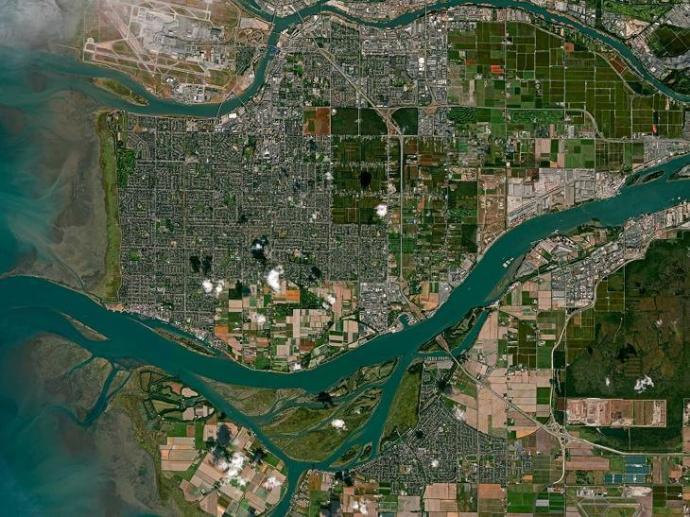
- Multispectral orthophotos: Access high-quality orthophotos across the United States, Europe, and parts of Canada in true colour (RGB) and colour-infrared (CIR).Our standardised, homogeneous data set is ideal for deriving analytics and extracting features with A.I. and machine learning algorithms.
Stereo imagery: Create detailed 3D visualisations with our highly accurate stereoscopics. The data set is great for feature and topography extraction as well as creating 3D object databases and vector maps.
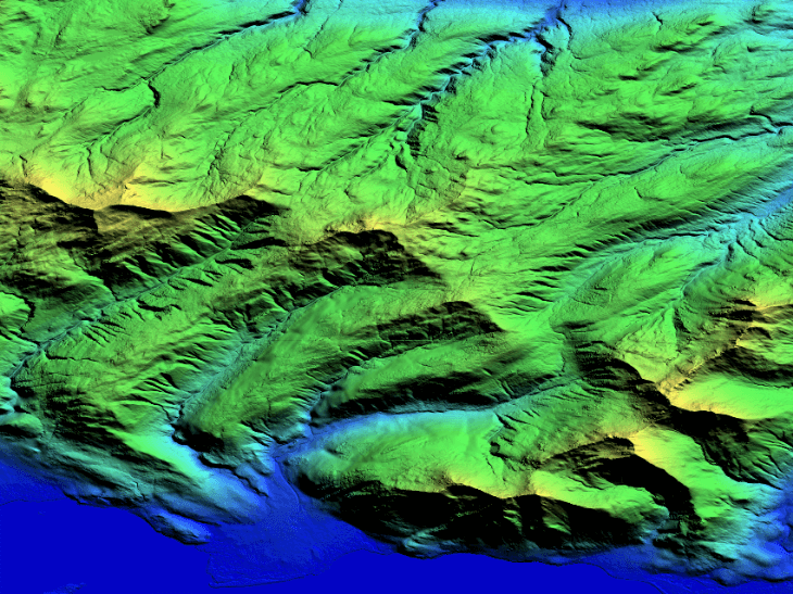
Elevation data: Confidently measure and analyse the elevation of the earth's surface and above-ground features with high-accuracy digital surface models (DSM).
Orthophoto | Stereo imagery | DSM | |
Spatial resolution | 15cm / 30cm | 1X GSD* | 0.25 m |
Accuracy XY | 0.50 m / 1.2 m | 1X GSD* | 2X GSD* |
Accuracy Z | - | 1X GSD* | 2X GSD* |
What's included | Two sets of 3-band delivered: - one set of RGB, - one set of CIR. | - Stereo models in sensor-specific format (pushbroom or frame). - Aerial images, exterior orientation parameters and sensor model description. | Compressed LAZ segmented per flight layout (ASPRS LAS 1.2 specification). |
| Coordinate Reference System (CRS)/ Vertical Datum | North America: Horizontal - UTM NAD83 (2011) epoch 2010 meters Europe: Horizontal - UTM IRTF2008 epoch 2005 (wgs84-g1674) | North America: Horizontal - UTM NAD83 (2011) epoch 2010 meters / Vertical - NAVD88 (Geoid12b) meters Europe: Horizontal - UTM IRTF2008 epoch 2005 (wgs84-g1674) / Vertical - EGM08 meters | North America: Horizontal - UTM NAD83 (2011) epoch 2010 meters / Vertical - NAVD88 (Geoid12b) meters Europe: Horizontal - UTM IRTF2008 epoch 2005 (wgs84-g1674) / Vertical - EGM08 meters |
Need a sample to test the product before ordering?
Key features
Extensive library of 4-band imagery at multiple resolutions
Available across the United States, Europe, and some parts of Canada
Up to 20 cm resolution or point spacing in the United States and 40 cm in Europe for elevation data
Elevation data of land surface and above-ground features in raster or point cloud format
Ideal for analytics and extracting features with A.I. and machine learning algorithms
Artefact-free and consistent coverage
Key applications

Infrastructure
Monitoring illegal construction
Creating a base map for visual reference
Planning evacuation plans in urban environments
Monitoring illegal construction
Creating a base map for visual reference
Planning evacuation plans in urban environments

Oil&Gas
Inspecting the condition of pipelines
Planning transportation, logistics, and emergency evacuation routes
Detection of best sites for exploration
Inspecting the condition of pipelines
Planning transportation, logistics, and emergency evacuation routes
Detection of best sites for exploration

Forestry
Tree health assessment
Identifying forest health threats
Classifying vegetation
Tree health assessment
Identifying forest health threats
Classifying vegetation
FAQs
For Othophoto products, please note that:
- the minimum order price is €86.00
- the minimum AOI is 25km²
For Stereo and DSM products:
- the minimum order price is €6600.00
- the minimum AOI is 700km².
A buffer of 200 meters applied around the original AOI to make sure nearby flight lines needed for stereo overlap weren’t missed.
The EULA of Hexagon Products can be found here.