21AT Basemaps / Large Area Mosaics
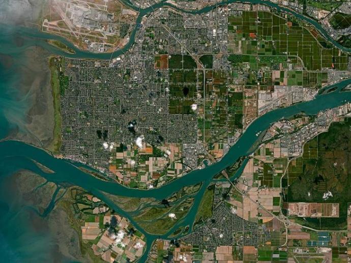
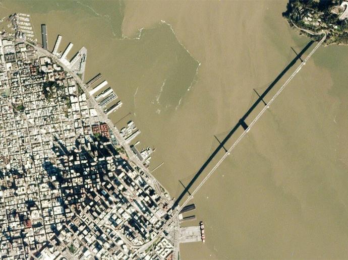
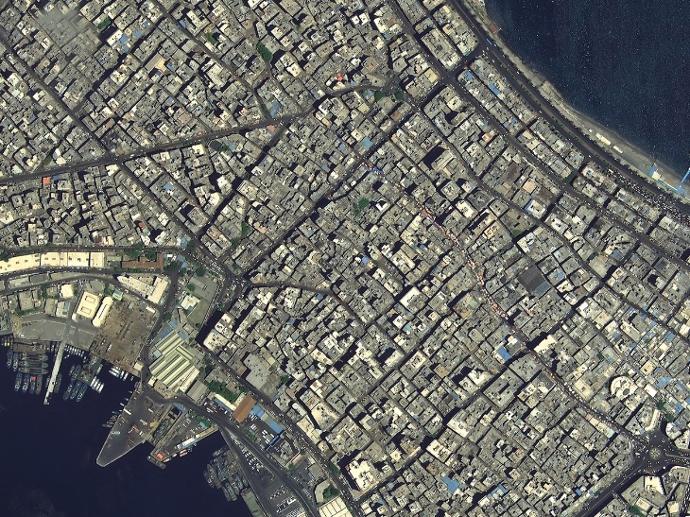
21AT Basemaps / LAM offer high-resolution ortho-imagery in three different resolutions: 50cm, 80cm, and 2m with band combinations of Red - Green - Blue or Red - Green - Blue - Near InfraRed for surface reflectance information. It is post-processed, orthorectified, seamlessly mosaicked, color-balanced, nearly cloudless, and best of all, with coverage available over whole countries or any large area.
They are updated annually and ensure you are getting current imagery. Archive Basemap uses imagery from the past 3 years to create the composite, while Basemap Plus uses imagery from the last 12 months.
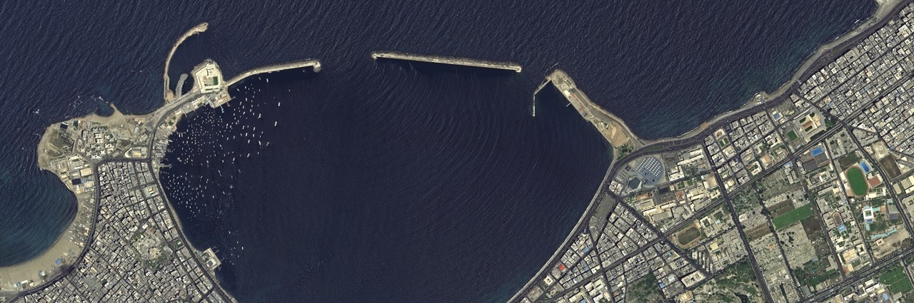
Basemaps provide the perfect backdrop to any mapping or analysis project, especially when imagery covering a large area is needed. They are ideal for infrastructure and city planning, mapping, ecological restoration, and emergency preparation.
Custom options include resolution (50cm, 80cm, or 2m), resampled lower-resolution imagery (from 2m to 10m), date ranges of the imagery used in the basemap (3-year composite, or fresh rolling 1-year archive imagery), RGB or RGBNR band combinations.
Need a sample to test the product before ordering?
Key features
Access to very high-resolution mosaics at up to 0.5m.
Updated annually to incorporate new images and stay current.
Color-balanced, nearly seamless ortho-photos.
<5% minimum cloud coverage per image mosaic.
4 most common spectral bands available (blue, green, red, near-infrared).
Product data ready to be used without any further processing.
Key applications
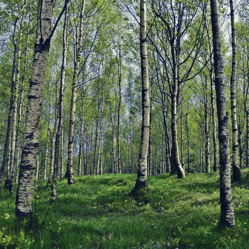
Forestry
Vegetation mapping in complex ecosystems
Canopy density estimation
Tree counting
Vegetation mapping in complex ecosystems
Canopy density estimation
Tree counting

Agriculture
Crop type classification and mapping
Layout and design creation for efficient irrigation
Number of plants per unit of area optimization
Crop type classification and mapping
Layout and design creation for efficient irrigation
Number of plants per unit of area optimization
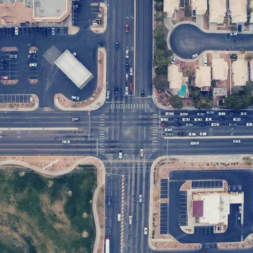
Infrastructure
High-quality basemap for visual reference
Shallow waters bathymetry
Urban mapping
High-quality basemap for visual reference
Shallow waters bathymetry
Urban mapping
FAQs
The temporal difference between Archive Basemap and Basemap Plus is that Archive Basemap uses imagery from the past 3 years to create the composite, while Basemap Plus uses imagery from the last 12 months.
More precisely:
Archive Basemap is based on TripleSat imagery captured within 36 Months. It has already covered all the countries in this world. Furthermore, to complete the base maps of difficult areas such as Guyana, Surinam and etc, old images and multiple satellite imagery data sources have been deployed.
Basemap Plus is based on TripleSat Imagery captured within 12 months and is updated annually, or it can be updated according to the requirements of customers. As for some key cities and areas of interest, more frequent updates on Basemap can be achieved. Please contact us for more information.
The minimum order size is 2000 sq.km.
In case more than one AOI or country is required, please contact us for a custom order tailored to your needs.
The EULA of 21AT Basemaps/LAM is under the authority of 21AT Asia and can be found here.